Forecast for the Uintas Area Mountains

Craig Gordon
Issued by Craig Gordon for
Friday, December 2, 2016

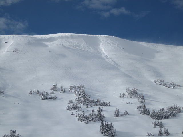
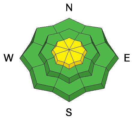
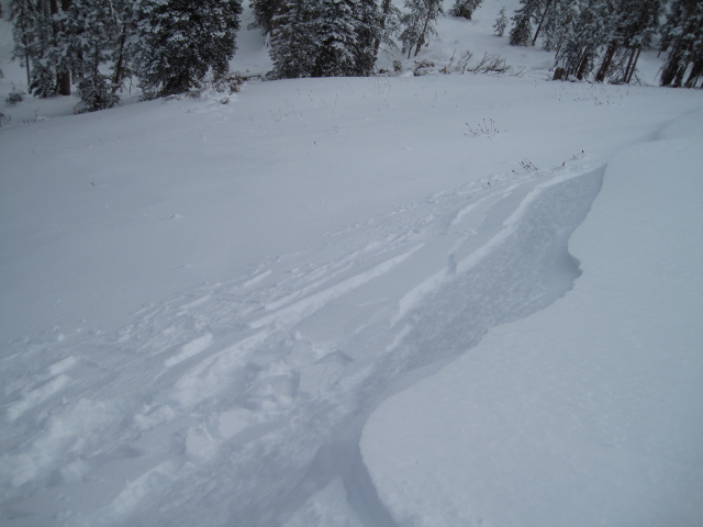
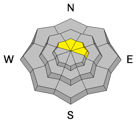
At mid and upper elevations, the avalanche danger is MODERATE today and human triggered avalanches are possible on steep, wind drifted slopes, especially shady slopes facing the north half of the compass. Any avalanche breaking into old snow will be deep and dangerous.

The avalanche danger in wind sheltered terrain and on low elevation slopes is generally LOW.
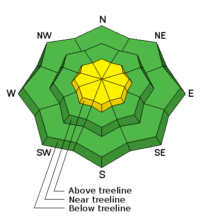
Low
Moderate
Considerable
High
Extreme
Learn how to read the forecast here
Special Announcements

I hope to see y'all tomorrow night!

Heads up- Plowing operations have ceased for Mirror Lake Highway. Wolf Creek Pass is still mostly pavement and access to avalanche terrain is relatively easy. Remember... just cause you can see your rig from a ridgeline doesn't necessarily make the terrain any safer and triggering even a small slide this time of year will reveal stumps, rocks, and general nastiness, easily ruining your day or perhaps your season.

Ted Scroggin photo

Weather and Snow

Skies are partly cloudy, temperatures in the single digits, and winds light and northerly, blowing just 10-15 mph along the high ridges. An inch or two of snow fell throughout the day Thursday and total snow depths are in the 24"-36" range... yep, it's starting to look like winter out there!

Real time wind, snow, and temperatures for the Uinta's are found here.

Recent observations are found here.

One of the friendly locals I met yesterday.

Recent Avalanches

I found no recent avalanche activity in my travels to Wolf Creek yesterday, but Ted spotted a few fresh wind drifts along the leeward side of Double Hill when he was in the Whitney basin Wednesday.

Ad
Avalanche Problem #1
Wind Drifted Snow
Type
Location
Likelihood
Size
Description

There might be a fresh wind drift or two, but in general these are isolated to the high elevation leeward slopes. While manageably breaking at or below your skis, board, or sled, remember... snow cover remains thin and any slide triggered today has the possibility to uncover stumps, rocks, or deadfall, resulting in an unexpected and possibly traumatic ride.


Test slopes like these give you great information about the snowpack. Tweak a few and see how they're reacting before you get into big terrain.

Avalanche Problem #2
Persistent Weak Layer
Type
Location
Likelihood
Size
Description

We're off to a good start in the Uinta's and our weak snow issues are isolated to a handful of upper elevation slopes facing the north half of the compass which retained snow from late September. While making up a small portion of the terrain available to ride in, if your travels take you into steep, upper elevation, north facing terrain, remember that any avalanche you trigger has the possibility of breaking into old snow, creating a deep, dangerous slide.

Here's a nice, deep pit from Weber Canyon. We haven't seen a solid homogenous snowpack like this for about 10 years. While things are looking good, there's still some weak snow near the ground we'll need to keep an eye on. Deutschlander photo.

My travels to the south half of the range yesterday revealed snow depths about half of the North Slope. However, most of the storm snow fell on bare, warm ground, creating a "right side up" snow structure.

Additional Information

Today we can expect partly cloudy skies and a snow flurry or two, before a short-lived ridge of high pressure moves in later today through Sunday. Todays highs reach into the low 20's and with clearing skies on tap, overnight lows crash to negative territory. We're still on track for a cold, moist system rolling through the region early next week. Stay tuned for more details coming your way this weekend.

General Announcements

Remember your information can save lives. If you see anything we should know about, please participate in the creation of our own community avalanche advisory by submitting snow and avalanche conditions. You can call me directly at 801-231-2170, email [email protected]

The information in this advisory is from the US Forest Service which is solely responsible for its content. This advisory describes general avalanche conditions and local variations always occur.

The information in this advisory expires 24 hours after the date and time posted, but will be updated on Saturday December 3rd.