Forecast for the Uintas Area Mountains

Craig Gordon
Issued by Craig Gordon for
Sunday, November 29, 2015

In general most terrain throughout the range offers a LOW avalanche danger.

However, at and above treeline, the avalanche danger is MODERATE. While pockety at best, human triggered avalanches are possible, on steep, wind drifted slopes facing the north half of the compass.

Low
Moderate
Considerable
High
Extreme
Learn how to read the forecast here
Weather and Snow

Scattered snow showers yesterday delivered another inch or two of very light density snow across the range. It's brisk this morning as temperatures bottomed out near zero degrees overnight and as of 5:00 AM, are struggling to climb into the single digits. Winds have been pretty well-behaved, blowing out of the south and southeast at 10-15 mph along the high peaks. Our western Uinta weather station network is up and running. Click here for real time snow, winds, and temperatures.

Ted visited the Whitney Basin yesterday and found a little deeper snow than what we observed on the south half of the range. None-the-less, it's still pretty shallow and riding options are limited to road rides or low angle grassy meadows.

Recent trip reports and observations are found here.

Recent Avalanches

Yesterday, Ted discovered this surprisingly long running natural avalanche on Double Hill. This slide most likely occurred Wednesday as a result of big Southerly winds.

See or trigger an avalanche? Shooting cracks? Hear a collapse? It's simple. Go here to fill out an observation.

Ad
Avalanche Problem #1
Wind Drifted Snow
Type
Location
Likelihood
Size
Description

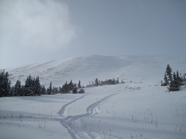
The Double Hill avalanche is a bit of an outlier and in general it's been pretty quiet along the eastern front so far this season. With just about 18"-24" of total snow depth, there's barely enough snow to get around and travel. Unfortunately, these shallow, early season snow conditions aren't boding well for the future as our thin snowpack gets progressively weak and sugary over time. So yea, you know the drill.... once it starts storming or even if the wind ramps up again, it's gonna be sketchy. However, in the mean time, the avalanche danger is pretty straight-forward and a few fresh drifts along the leeward side of upper elevation ridges is today's main avalanche concern. Remember- it's still really thin out there and even a shallow slide can take you for a nasty ride through rocks and stumps barely hidden under our shallow snowpack.

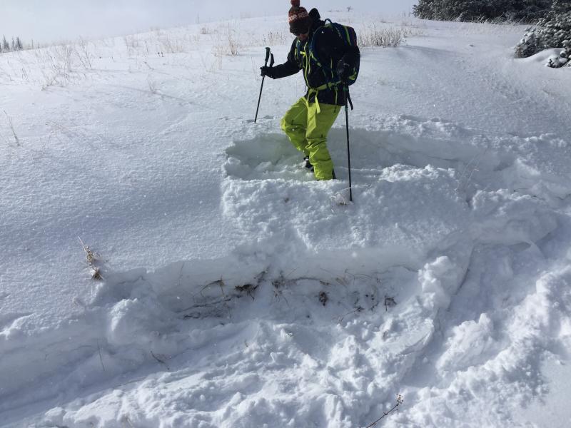
Trent stomps on what we call a "test slope" which gives us a baseline to how to snow might react. A "test slope" is usually a road cut or similar terrain feature that has little or no consequence if it does avalanche. In this case, the snow was pretty was pretty well-behaved.

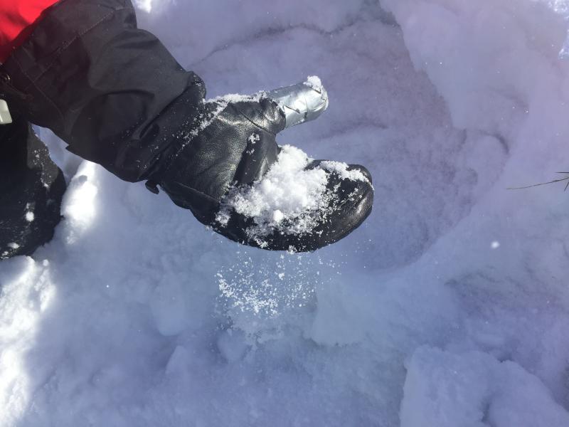
Weak, sugary snow pours off my mitten.... not a good setup if winter returns from its hiatus.

Additional Information

One more day of light snow and cold temperatures. It'll be crisp today, with highs barely reaching into the low teens and overnight lows near zero. Winds shift to the northwest late in the day, but should remain in the 10-20 mph range along the high ridges. High pressure builds for next week with a slow warming trend on tap. A splitting storm is slated for late in the work week.

General Announcements

Remember your information can save lives. If you see anything we should know about, please participate in the creation of our own community avalanche advisory by submitting snow and avalanche conditions. You can call me directly at 801-231-2170, email [email protected], or email by clicking HERE

This is a great time of year to schedule a free avalanche awareness presentation for your group or club. You can contact me at 801-231-2170 or email [email protected]. To register for the first in our series of on-the-snow sled specific classes you can register here.

The information in this advisory is from the US Forest Service which is solely responsible for its content. This advisory describes general avalanche conditions and local variations always occur.

The information in this advisory expires 24 hours after the date and time posted, but be will be updated by 7:00 AM on Wednesday, December 2nd.