UDOT PLANNED AVALANCHE CLOSURES!!

Forecast for the Uintas Area Mountains

Mark Staples
Issued by Mark Staples for
Friday, November 17, 2017

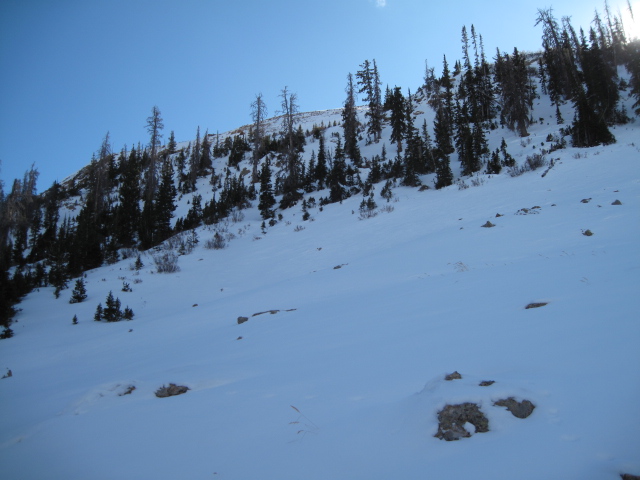
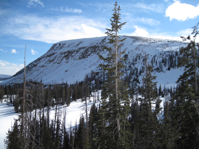
Today's new snow is creating a thick slab on top of many slopes with old, weak snow underneath that will cause avalanches at the upper elevations. Strong winds will make the problem worse and any fresh wind drifts should be avoided because they will be easy to trigger. For today above treeline, the avalanche danger is CONSIDERABLE. It's exciting to see so much new snow, and the easiest way to get out and have some fun is to simply go to low angle slope less than 30 degrees where you don't have to worry about avalanches.
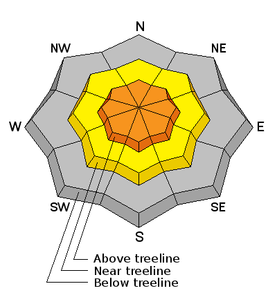
Low
Moderate
Considerable
High
Extreme
Learn how to read the forecast here
Weather and Snow

Warm, wet, heavy snow is stacking up this morning with temperatures near freezing this morning and 10 inches of snow (containing 1.7 inches of water) as of 9 am at the Trial Lake SNOTEL Site along the Mirror Lake Highway at 10,000 ft.

Below are the UDOT camera images from Wolf Creek Summit at 9400 ft.

http://udottraffic.utah.gov/1_devices/RWIS-SR35-Wolf-Creek-Pass.gif
Ted was near Bald Mountain Pass and Murdock peak on Tuesday and found many slopes other than south facing ones were starting to get covered with snow. This old snow will be a problem because it is weak and faceted. With today's new snow being the slab, the old snow being the weak layer underneath, we have all the ingredients for an avalanche.

South facing slopes even above 10,000 feet were still bare.

Ad
Avalanche Problem #1
Persistent Weak Layer
Type
Location
Likelihood
Size
Description

Old snow from September and October became weak and faceted. With today's dense, heavy snow on top with more coming, I'd expect avalanches today especially on north facing slopes where the old snow existed before this storm. Strong winds will make it worse. Of course, these will be the slopes with the best coverage. The SOLUTION - stick to low angle slopes less than 30 degrees for now. Because the snow is so thin, getting caught in an avalanche will be painful as it runs you over rocks and stumps.

See Ted's video below

MVI_5593 from ted scroggin on Vimeo.

Avalanche Problem #2
Wind Drifted Snow
Type
Location
Likelihood
Size
Description

New snow and strong winds are a guaranteed recipe for avalanches. Avoid fresh wind drifts.

Additional Information

Temperatures will be dropping today and may get into the mid teens F by the end of the day and single digits tonight. Snow will continue with another 4-8 inches possible. Also, SW winds will be blowing 20-30 miles per hour and gusting to 40 mph. The highest peaks could see some winds of 60 mph.

General Announcements

I'll be issuing regularly scheduled advisories once the snow starts flying in earnest. In the meantime, if you're getting out and about, please let me know what you're seeing especially if you see or trigger and avalanche. I can be reached at [email protected] or 801-231-2170

It's also a good time to set up one of our very popular avalanche awareness classes. Reach out to me and I'll make it happen.