Forecast for the Salt Lake Area Mountains

Evelyn Lees
Issued by Evelyn Lees for
Thursday, December 21, 2017

The avalanche danger is MODERATE today - human triggered avalanches are possible on steep upper and mid elevation slopes with recent wind drifts. The old, harder drifts are hidden beneath last night’s few inches of new snow, and may be hard to identify. A few new drifts may form from today's winds. Out of the wind-affected terrain, loose snow sluffs can be triggered, and could be larger and run further than expected.

Due the shallow snowpack, being caught and carried by even a small avalanche could be very dangerous, as you will be dragged through shallowly buried rocks or downed trees.

Low
Moderate
Considerable
High
Extreme
Learn how to read the forecast here
Special Announcements

For the 2017/2018 winter, we're excited to introduce the Utah Avalanche Center podcast, hosted by forecaster Drew Hardesty and produced by KUER's Benjamin Bombard. On the podcast, you'll find engaging stories, interviews, and lessons learned - all things avalanche, all to help Keep people on top of the greatest snow on earth instead of buried beneath it - and easily found on ITunes, Stitcher, the UAC blog, or wherever you get your podcasts. You can find the first podcast, released yesterday here.

Don’t know what to buy your favorite skier for Christmas? Discount lift tickets for Alta, Snowbird, Brighton, Solitude, Deer Valley, Snowbasin,and Beaver Mountain are now available, donated by the resorts to benefit the Utah Avalanche Center. Details and order information here. These make a great holiday gift and all proceeds go towards paying for avalanche forecasting and education!

Weather and Snow

Skies are cloudy, and very light snow is still falling in the mountains. While a few inches of 5% density snow is less than hoped for, I’m always amazed how even a little snow makes touring and riding more fun. Snow totals:

  • Ogden area mountains – 1 to 5”
  • Park City side – 2 to 4”
  • Cottonwooods – 5 to 9”
  • Provo area mountains – 1 to 3”

While temperatures are in the single digits and low teens, the northwesterly winds are just strong enough to make it feel like -15°F (wind chill factor). So bundle up – wind speeds are expected to remain in the 10 to 20 mph range, with speeds across the high peaks averaging 15 to 25 mph, gusting to 30 mph.

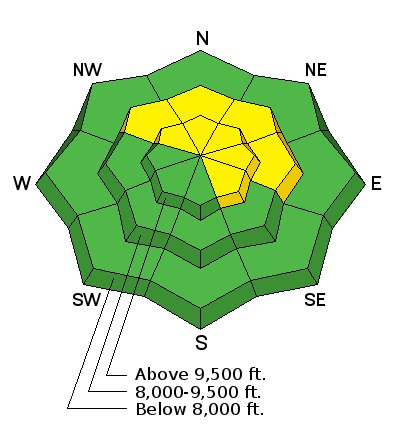
The dusting of snow will have hidden the numerous rocks and stumps sticking out of our shallow snowpack – which is only 1 to 2 feet deep on the shady, mid and upper elevation slopes. Most southerly facing slopes were bare before yesterday.

Recent Avalanches

No new avalanche activity has been reported.

Ad
Avalanche Problem #1
Wind Drifted Snow
Type
Location
Likelihood
Size
Description

Yesterday, hours of strong, southwesterly winds drifted what snow it could find onto a variety of aspects and elevations. These drifts will be most dangerous on northwest through southeasterly facing slopes, where they landed on weak, faceted snow. A few new dirfts will form as today's northerly winds blow around the light density snow.

  • You may find more drifts off the ridgelines and even mid slope, than right along the ridgelines.
  • You will be able to trigger these drifts from a distance, or worse, from below.

I’d approach steep slopes cautiously today– any cracking, collapsing or change in snow density in your travels are indications of wind drifts, and is a warning you should avoid steep slopes.

Avalanche Problem #2
New Snow
Type
Location
Likelihood
Size
Description

Out of the wind-affected terrain, you may be able to trigger loose snow sluffs in the new snow. If you get a sluff moving, it could entrain or scoop up more snow as it moves downhill, and run further, faster and become larger than expected

Avalanche Problem #3
Persistent Weak Layer
Type
Location
Likelihood
Size
Description

After 3 weeks of high pressure, the snowpack is composed of very weak faceted snow and crusts wherever there was snow on the ground before this storm. While this storm wasn’t large enough to overweight the old snow, a triggered avalanche just might be able to step down. So keep focused on this weak snow. There is always a first avalanche to a cycle.

Additional Information

This morning’s snow flurries will give way to partly sunny skies by afternoon. But brisk winds and temperatures only warming into the teens will make for a cold day in the mountains. The northwesterly winds will remain in the 10 to 20 mph range, with speeds along the ridgelines averaging 25 mph, with gusts to 30. Friday, skies will be partly sunny and temperatures slightly warmer. There’s another chance for a small shot of snow Friday night into Saturday.

General Announcements

FOR MORE GENERAL INFORMATION CLICK HERE

Benefit the Utah Avalanche Center when you buy or sell on ebay - set the Utah Avalanche Center as a favorite non-profit in your ebay account here and click on ebay gives when you buy or sell. You can choose to have your seller fees donated to the UAC, which doesn't cost you a penny.

This information does not apply to developed ski areas or highways where avalanche control is normally done. This advisory is from the U.S.D.A. Forest Service, which is solely responsible for its content. This advisory describes general avalanche conditions and local variations always occur.