Forecast for the Moab Area Mountains

Eric Trenbeath
Issued by Eric Trenbeath for
Monday, December 5, 2016

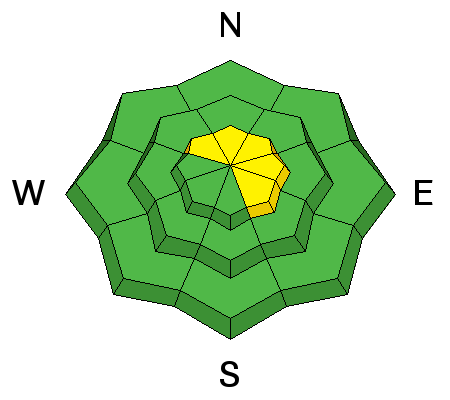
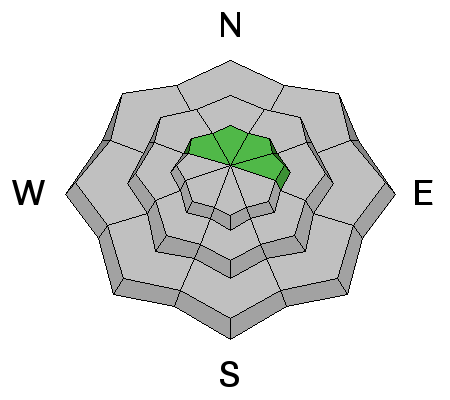
The avalanche danger remains MODERATE on steep upper elevation slopes that have recent deposits of wind drifted snow. There also remains a remote possibility of triggering a deeper, persistent slab on upper elevation, northerly aspects, in areas of steep, rocky, and more radical terrain.

Elsewhere the avalanche danger is generally LOW.

Low
Moderate
Considerable
High
Extreme
Learn how to read the forecast here
Weather and Snow

It was an outstanding weekend in the mountains and people were out and about, pushing into terrain not often visited this early in the season. Excellent powder conditions over a supportable base can still be found on sheltered northerly aspects, but it's been a week since we received any significant snow fall, and the early season snow pack is beginning to dwindle. Rocks and dead fall lurk just beneath the snow surface posing the threat of injury or damage to a machine. Base depth in Gold Basin is 29".

WSW winds have been on the increase overnight and are currently blowing in the 20-30 mph range with gusting into the 40's. It's a balmy 30 degrees at the Geyser Pass Trailhead and 19 on Pre Laurel Peak.

Storm totals and temperature in Gold Basin.(10,000')

Wind, temperature and humidity on Pre Laurel Peak.(11,700')

Snow totals, temperature and snow/water equivalent at the Geyser Pass Trailhead.(9600')

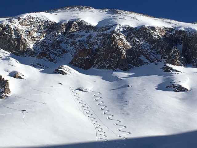
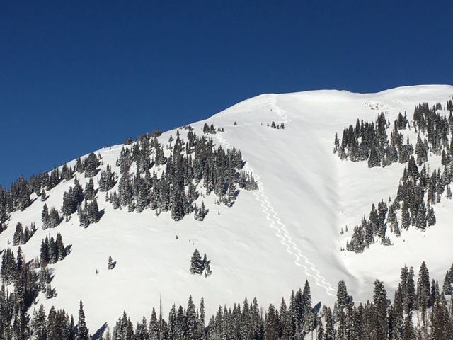
Local skier Mark Sevenof sent in this eye candy from upper Gold Basin. As good as it looks, it's still pretty thin.


Overall, not bad for early December though!

Recent Avalanches

Ed Grote reported a new, long running point release sluff that released in Gold Basin on Sunday. He was also able to crack out an older wind slab up to 12"-18" deep that had drifted in on the leeward side of a sub ridge on an upper elevation, northerly aspect.

Ad
Avalanche Problem #1
Wind Drifted Snow
Type
Location
Likelihood
Size
Description

Wind slabs old and new continue to present themselves in upper elevation, wind exposed terrain. Though mostly isolated to individual terrain features, a wind slab triggered in the wrong place could take you for a ride over rocks or a cliff and seriously ruin your day. Look for smooth, rounded deposits of wind drifted snow, and be alert to signs of instability such as cracking or collapsing in the snowpack.

Avalanche Problem #2
Persistent Weak Layer
Type
Location
Likelihood
Size
Description

The possibility of triggering a deeper, persistent slab is remote at this time. The development of an instant snow pack up to 4' deep over a period of 2 weeks created a mostly strong and stable base with limited facet growth. A mid-pack weak layer continues to produce sheers that don't propagate, but by and large the overall snow pack is mostly stable. Over the past week however, the snow pack has shown signs of weakening with accelerated facet development near the ground, particularly in shallower, rocky areas. This will be something to pay attention to as time goes on, and when we get more snow. Given that, it's still always a good idea to assess the snow pack before venturing into suspect terrain which in this case refers to upper elevation slopes with a northerly aspect.

Additional Information

A series of fast moving Pacific storm systems will move through the region over the next 48 hours with most of the energy tracking to the north. We'll see mostly an increase in winds with a chance of snow developing tonight through Tuesday.

Monday

Mostly sunny, with a high near 22. Blustery, with a west wind 20 to 25 mph, with gusts as high as 40 mph.

Monday Night

A 20 percent chance of snow showers before 1am. Partly cloudy, with a low around 11. Blustery, with a west southwest wind 15 to 25 mph.

Tuesday

A 40 percent chance of snow showers after 11am. Areas of blowing snow after 5pm. Increasing clouds, with a high near 19. Breezy, with a southwest wind 15 to 20 mph.

Tuesday Night

Snow showers likely, mainly before 11pm. Widespread blowing snow before 11pm. Cloudy, then gradually becoming partly cloudy, with a low around 0. Wind chill values as low as -20. Blustery, with a northwest wind 15 to 20 mph, with gusts as high as 30 mph. Chance of precipitation is 60%. New snow accumulation of 2 to 4 inches possible.

Wednesday

A 20 percent chance of snow before 11am. Sunny and cold, with a high near 9. Northwest wind 10 to 15 mph.

Wednesday Night

Mostly clear, with a low around 1.

Thursday

Sunny, with a high near 19.

Thursday Night

A chance of snow, mainly after 11pm. Mostly cloudy, with a low around 13.

Friday

A chance of snow. Mostly cloudy, with a high near 23.

General Announcements

The road to Geyser Pass Trailhead is plowed and clear.

Grooming of cross country trails has commenced for the season. Matt got out on Saturday and rolled out everything through Gold Basin. We'll have the Ginzu groomer setting track by the weekend.