Forecast for the Moab Area Mountains

Issued by Eric Trenbeath for
Sunday, November 29, 2015
Sunday, November 29, 2015
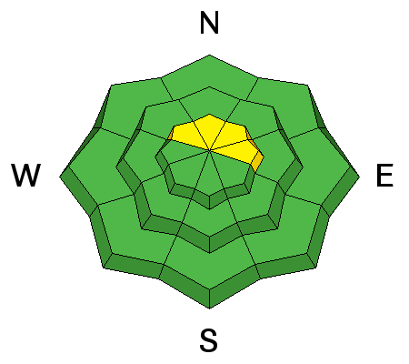
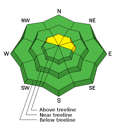
The avalanche danger is generally LOW at this time, but there is an isolated or MODERATE danger for triggering a recently deposited, soft, shallow wind slab along the lee sides of upper elevation ridge crests that face NE-N-NW. There also remains a very isolated, or MODERATE danger for triggering a persistent slab on slopes steeper than 35 degrees with a NW-N-E aspect right around tree line and above, in areas of rocky and radical terrain.
Low
Moderate
Considerable
High
Extreme
Learn how to read the forecast here