Forecast for the Logan Area Mountains

Toby Weed
Issued by Toby Weed for
Wednesday, December 7, 2016

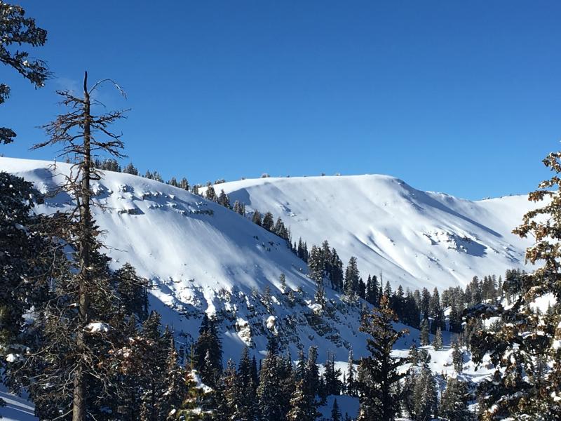
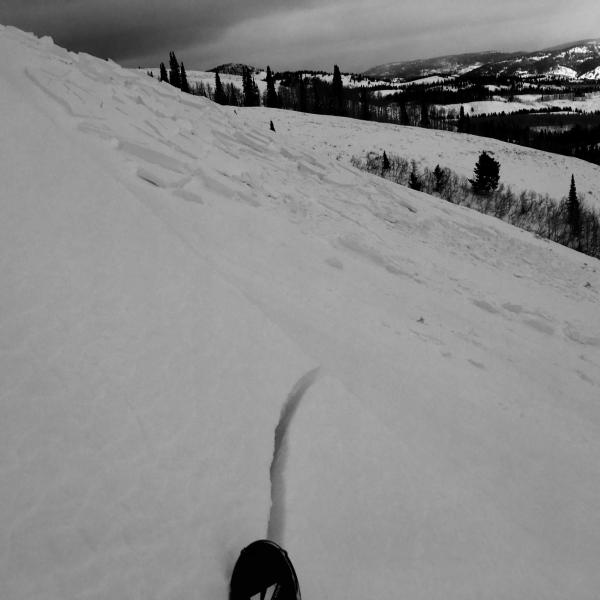
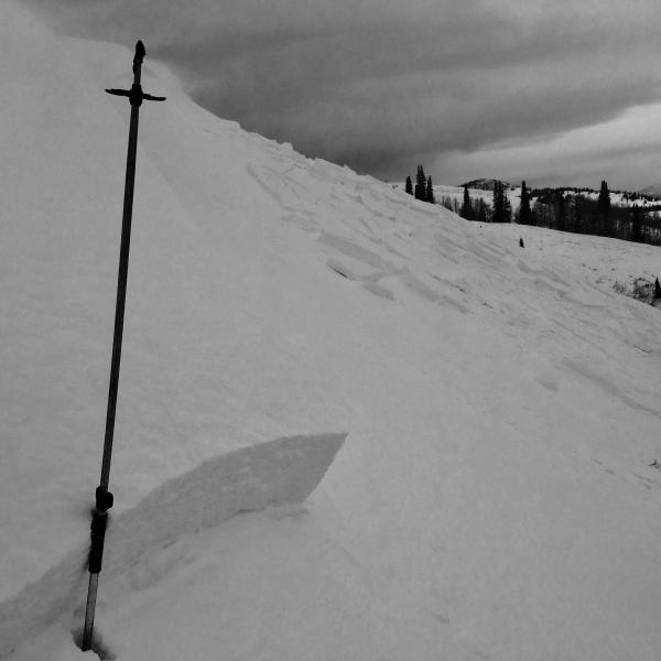
Watch your partners for frostbite and prepare for below zero temperatures in the backcountry again today. Heightened avalanche conditions persist on drifted upper elevation slopes, and triggered wind slab avalanches are possible.

  • Very shallow early season snow cover exists in the backcountry, and hitting rocks is still a serious concern.
  • You don't want to take a ride even in a small avalanche, as you could easily be injured with the shallow snow hardly covering up the rocks and dead-fall in avalanche runout zones.
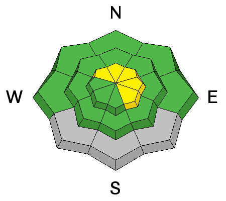
Low
Moderate
Considerable
High
Extreme
Learn how to read the forecast here
Special Announcements

Our annual Pray for Snow fundraiser/party is TONIGHT at the Italian Place in downtown Logan. For tickets and information Go...HERE


Weather and Snow

Looks like we picked up a little taste of snow overnight, and it's wicked cold in the mountains this morning with 3 degrees below zero at the UDOT Hwy 89 summit and 4 below at the CSI Logan Peak weather station. I'm reading fairly moderate west winds averaging in the upper single digits. With very shallow early season snow conditions, rocks and dead-fall are only shallowly buried and you need to be extra careful and keep your speed down in the backcountry.

The extremely cold air temperature is causing a significant temperature gradient through the shallow snowpack. This difference in temperature is driving sublimation of water vapor through the snow, and rapid development of weak faceted snow. I was impressed Monday by how quickly this is occurring, especially where there is less than about 2' of snow cover.

Still a bit shallow to ride on most slopes in the backcountry, so the weakening snow remains untracked, untested, and undisturbed.


  • Remember, the Tony Grove Road is a busy shared use area, so you have to watch your speed around pedestrians and dogs. The road is not maintained for driving in the winter, so be prepared with shovel and winter survival gear.
  • Beaver Mountain welcomes up-hill hiking traffic this time of year as it helps to pack out the slopes, but you should consider it as "backcountry terrain" before they open the lifts to the public.

Recent Avalanches

A skier remote triggered a wind slab avalanche Sunday afternoon as he was walking along the east ridge of Chicken Hill in the Bunch Grass drainage.

Drifting Sunday created sensitive wind slab avalanche conditions in exposed terrain. (12-4-2016)


Ad
Avalanche Problem #1
Wind Drifted Snow
Type
Location
Likelihood
Size
Description

In some areas drifts formed earlier in the week on small-grained near surface facets. This granular sugary snow is known to often become a persistent weak layer, and in some cases, the wind slabs are likely to remain unstable for a little while.

Additional Information

It'll be sunny, but quite cold in the mountains today, with below zero temperature readings at several Bear River Range weather stations this morning. The very cold conditions will last through tonight, with sub-zero temperatures again expected, but conditions will start to warm Thursday ahead of a series of mild but moist storms scheduled to last through the weekend. Significant accumulations are possible in the mountains of northern Utah beginning tomorrow night, with a foot or so of new snow possible by Friday morning and more than 2 feet by Saturday...!


Thursday: Snow, mainly after noon. High near 16. Wind chill values as low as -21. South southwest wind 9 to 18 mph. Chance of precipitation is 90%. New snow accumulation of 1 to 2 inches possible.
Thursday Night: Snow. Low around 16. Wind chill values as low as -2. Southwest wind 16 to 20 mph. Chance of precipitation is 90%. New snow accumulation of 6 to 10 inches possible.
Friday: Snow. High near 28. Breezy, with a southwest wind 13 to 22 mph. Chance of precipitation is 90%. New snow accumulation of 5 to 9 inches possible.
Friday Night: Snow. Low around 22. Breezy. Chance of precipitation is 90%. New snow accumulation of 7 to 11 inches possible.
Saturday: Snow. High near 24. Breezy. Chance of precipitation is 90%. New snow accumulation of 2 to 4 inches possible.


General Announcements

The early season is a great time to refresh yourself and practice companion rescue techniques with your partners.


Check out Avalanche Canada's "Rescue at Cherry Bowl" story HERE

Between now and Jan 15th: Donate to the Utah Avalanche Center by shopping at Whole Foods Market Utah! When you visit any Utah Whole Foods Market locations, bring your re-usable bags, Whole Foods will donate a dime per bag to the Utah Avalanche Center - if you say DONATE my bag credit.

Remember your information can save lives. If you see anything we should know about, please help us out by submitting snow and avalanche observations. You can also call us at 801-524-5304, email by clicking HERE, or include #utavy in your Instagram. In the Logan Area you can get ahold of your local avalanche forcaster, me (Toby Weed), at 435-757-7578

This advisory is from the U.S.D.A. Forest Service, which is solely responsible for its content. This advisory describes general avalanche conditions and local variations always exist.