
In partnership with: Utah Division of State
Parks and Recreation, The Friends of the Utah Avalanche Center, Utah Department
of Emergency Services and Homeland Security and
AVALANCHE ADVISORY
Wednesday,
March 15, 2006 12:00am update
Good morning, this is Evelyn Lees with
the
Current Conditions:
Yesterday, someone cranked
the wind dial to high, and forgot to turn it off. Strong, southerly winds continued through
midnight, with many locations averaging 25 mph, with gusts in the 40’s to 60’s. With the cold front’s arrived shortly after midnight, the winds shifted to
the west and northwest, and decreased slightly into the 15 to 25 mph range with
gusts in the 30’s and 40’s. Temperatures
are dropping; back down into the teens and single digits. About 4 to 8” of new snow has fallen. Wind and sun damage and avalanche danger
should have backcountry travelers seeking lower angle, wind sheltered, shady
slopes for turning and riding today.
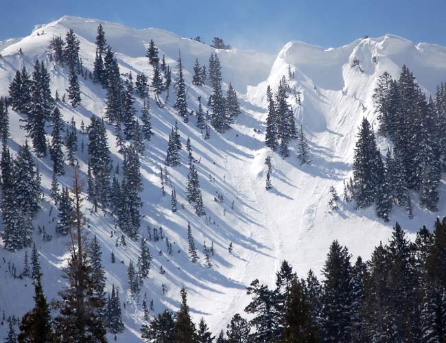
Recent Avalanche Activity & Snowpack Discussion:
Yesterday’s strong southerly
winds rapidly created soft and hard drifts or slabs, with the cold light
density snow below as the weak layer. A natural
avalanche cycle in upper elevation, wind effected terrain began by 9:30 am in
the
The multiple wind directions
have created wind drifts on a variety of aspects and elevations. While the drifts are most widespread on upper
elevation ridgelines, the strong winds have also deposited snow at the mid
elevations, down into open bowls, and drifted it around gully walls, sub ridges
and steep breakovers.
People will need to travel
very cautiously in the backcountry, avoiding today’s new wind drifts and yesterday’s
drifts that hidden beneath the new snow.
The old drifts will be stubborn and want to break above you. Many slopes will be scoured, but travel a few
steps in the wrong direction and you’ll be standing or riding on a dangerous
wind drift. In addition, there are a few
deeper weak layers of facets and crusts that no one trusts, and it may be
possible for a few slides to step down into these deeper layers.
Constantly reevaluate the
weather conditions - if you are in an area where intense snowfall rates or strong winds continue
longer than expected this morning, the avalanche danger may rise briefly rise to
HIGH.
Bottom Line:
The avalanche danger is CONSIDERABLE on all slopes steeper than 35 degrees above about 9,000’. The angerous wind
drifts are most widespread on northwest through easterly facing slopes, and
many are hidden beneath the new snow. Human triggered slides are probable and natural
avalanches possible, so avoid
travel in avalanche runout zones below steep slopes. Backcountry travelers need excellent route finding
and snow evaluation skill, and should carry beacons, shovels and probes, and carefully
follow safe travel procedures.
Mountain Weather:
Moderate to heavy snow should continue through mid morning, with an
additional 3 to 5 inches possible. Snow
will taper off to light showers by noon as the storm moves east of the area. Winds will gradually decrease today, into the 15
to 20 mph range from the west. Temperatures
will be in the mid 20’s at 8,000’ and in the low teens at 10,000’. High pressure will build in across the region
tonight, with cloudy skies and an increasing southwest flow developing on Thursday. Another storm system will affect the area
Friday through the weekend.
Announcements:
An initial report from the Snowbasin backcountry
incident can be found here.
Here is a great link to a web site on avalanche beacon
information, created by a person who did independent research and testing of avalanche
beacons. http://beaconreviews.com
There are several free
automated avalanche beacon practice areas open, including one at Canyons, one
on the by-pass road near Snowbird, one in the northwest corner of the lower lot
at Solitude, and at the Nobletts parking area on the
Early birds and snow
geeks can catch our 6AM report at 364-1591.
Click here to check out our new online avalanche
encyclopedia.
Click HERE for a text only version of the avalanche advisory.
To
have this advisory automatically e-mailed to you each day, click HERE.
UDOT also has a highway avalanche control work
hotline for Big Cottonwood, Little Cottonwood, and
The
Wasatch Powderbird Guides didn’t get out yesterday and will probably not fly today.
If they can possibly fly today, northern powder circuit and
American Fork. For more info,
call 742-2800.
Please
report any backcountry snow and avalanche conditions. Call (801) 524-5304 or 1-800-662-4140, email [email protected] or fax 801-524-6301. The information in this advisory is from the
U.S. Forest Service, which is solely responsible for its content. This advisory describes general avalanche
conditions and local variations always occur.