Observation: Ant Knolls

Observation Date
4/7/2024
Observer Name
Kelly, Brackelsberg, Davis
Region
Provo » Snake Creek » Ant Knolls
Location Name or Route
Snake Creek- Dry Fork
Weather
Sky
Scattered
Precipitation
Light Snowfall
Wind Direction
Northeast
Wind Speed
Light
Weather Comments
Skies were scattered to overcast to blue sky with light snowfall and periods of moderate to heavy snowfall particularly in Dry Fork. Winds in the basins were north-north east and temperatures were in the teens to mid 20's °F at higher elevations and low to mid 30's °F at the lowest elevations.
Snow Characteristics
New Snow Depth
12"
New Snow Density
Medium
Snow Surface Conditions
Powder
Snow Characteristics Comments
There was approximately 12" of settled snow north of Ant Knolls and in Dry Fork. Lower elevations and further south of Ant Knolls there was closer to 6" of settled snow depth. The melt-freeze layer under the newest snow was still damp and we didn't see any weaknesses involving density changes in the newest snow. On solar aspects (south and west) the old snow surface was very slick. As the day heated snow at the lower elevations became damp and it was easy to make a snowball. Some damp surface crusts with new snow on top formed with sun/cloud in/out through the day.
Avalanche Problem #1
Problem
Wind Drifted Snow
Trend
Decreasing Danger
Problem #1 Comments
We saw one fresh wind-drifted snow avalanche on a north facing slope at 9300'. This was a steeper slope. The avalanche had a small 8"-10" crown that was approximately 50' wide and ran 200' vertical feet. This was a small avalanche and was not deep enough to have buried a rider. We also observed some natural avalanches that occurred during the storm and were covered over by new snow. These also looked like they had chunks of cornice in them.
Snow Profile
Aspect
Northeast
Elevation
8,600'
Slope Angle
33°
Comments
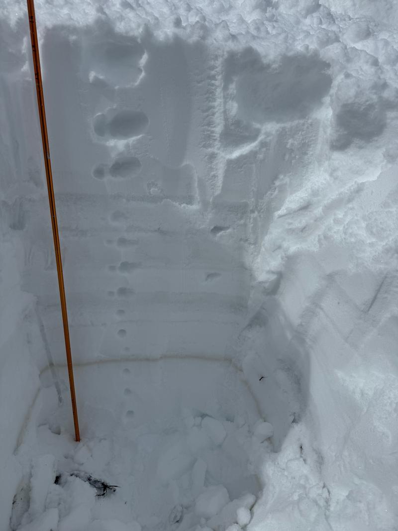
Overall good stability and in this location there was no instabilities noted in the newest snow. The old snow surface was a damp melt-freeze crust and the newest snow had bonded well to the old surface. 3 distinctive melt-freeze crusts and the dirt layer (not a MFcr). I would venture a guess that this moist old snow surface may have a temperature gradient and is something to watch with colder temperatures over the next few days as there may be places with small grained facets above the uppermost crust in protected areas where the snow surface has stayed cold.
We went out with a mindset of assessing terrain before committing to slopes greater than 30 ° in steepness. We saw small avalanches (see above) from during the storm; otherwise we saw very little avalanche activity. The winds had decreased in speed and the cold temperatures kept the sun at bay and never created wet snow problems where we traveled.
Today's Observed Danger Rating
Moderate
Tomorrows Estimated Danger Rating
None
Coordinates