Observation: Ant Knolls

Observation Date
3/24/2024
Observer Name
Kelly, Brackelsberg, Davis, Spencer, Gonzales
Region
Provo » Snake Creek » Ant Knolls
Location Name or Route
Ant Knolls
Weather
Sky
Scattered
Precipitation
Moderate Snowfall
Wind Direction
West
Wind Speed
Light
Weather Comments
Skies were overcast to clear. Some periods of intense snowfall and some periods of sun. Winds were primarily out of the west blowing lightly gusting stronger at times.
Snow Characteristics
New Snow Depth
10"
New Snow Density
Medium
Snow Surface Conditions
Powder
Snow Characteristics Comments
Snow surface was primarily new snow on top of a melt-freeze crust that was still in the melt phase. We saw between 10"-12" of new snow and more snow fell during the day.
Red Flags
Red Flags
Recent Avalanches
Heavy Snowfall
Avalanche Problem #1
Problem
New Snow
Problem #1 Comments
We observed a number of soft shallow new snow avalanches that were running on a density change 2" above the melt-freeze crust. In some locations these were more dry loose point releases and we saw some natural point releases on east facing slopes at 9,200' (photo below).
Below photo of an intentionally triggered soft slab avalanche on an east facing slope at 7,800'
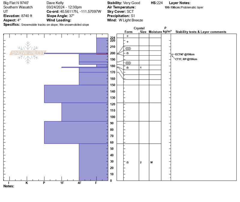
Snow Profile
Aspect
North
Elevation
8,700'
Slope Angle
37°
Comments
Weakest layer was approximately 12"-14" below the surface underneath a melt-freeze crust. This layer did not have propagation with an extended column test. The snowpack in this location was most very stable with very little weak snow. The snow on the ground was rounding facets that were moist. We observed and were able to trigger a number of small 6"-8" soft slab avalanches that were running on a density change 2" above the melt-freeze crust. Later in the afternoon at 7,000' this density change was no longer present and the new snow had bonded well to the old snow surface.
Today's Observed Danger Rating
Moderate
Tomorrows Estimated Danger Rating
None
Coordinates