Observation: Park City Ridgeline

Observation Date
3/24/2024
Observer Name
Paradis / Brackelsberg
Region
Salt Lake » Park City Ridgeline
Location Name or Route
Park City Ridgeline
Weather
Sky
Broken
Precipitation
Light Snowfall
Wind Direction
Northwest
Wind Speed
Light
Weather Comments
Somewhat variable but generally light to moderate snow with overcast skies. At times there was also brief heavy snow in the morning, then some sunny breaks. Wind wasn't bad while skiing but had been strong overnight.
Snow Characteristics
New Snow Depth
12"
New Snow Density
Medium
Snow Surface Conditions
Powder
Snow Characteristics Comments
Strong NW winds redistributed snow that fell overnight. In some places wind had left only a small amount of new snow over old melt-freeze crusts. The strength of these crusts varied a bit. In some places they would crack under your weight but in others they were pretty stout and made for slippery skinning. Where the wind had not affected the snow, lower angle skied better because you wouldn't cut into the crusts.
Red Flags
Red Flags
Recent Avalanches
Heavy Snowfall
Wind Loading
Red Flags Comments
On the ascent we observed several small avalanches in the trees that probably occurred during periods of heavy precipitation. There was also a small natural below a cornice at the top. See photos below for examples. As we were setting the skin track there was also minor cracking.
Avalanche Problem #1
Problem
Wind Drifted Snow
Trend
Decreasing Danger
Problem #1 Comments
On the ascent, we noticed small wind drifts in the lee of trees that indicated strong NW winds while the snow fell. These pointed to lee slopes where more snow had surely been deposited. On our way out I was able to triggered an avalanche from the ridge in wind deposited snow. See separate avalanche observation.
Comments
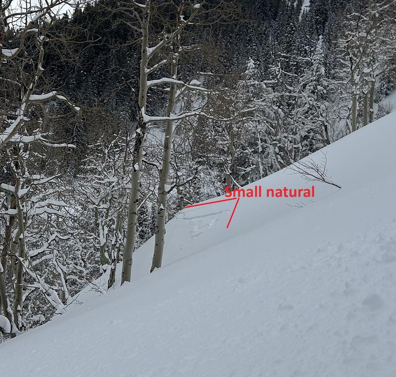
We saw a couple small naturals like this that probably occured during periods of intense precipitation.
Today's Observed Danger Rating
Considerable
Tomorrows Estimated Danger Rating
Considerable
Coordinates