

Observation Date
3/21/2024
Observer Name
Hardesty
Region
Salt Lake » Little Cottonwood Canyon » Alta Periphery
Location Name or Route
Alta perimeter
Comments
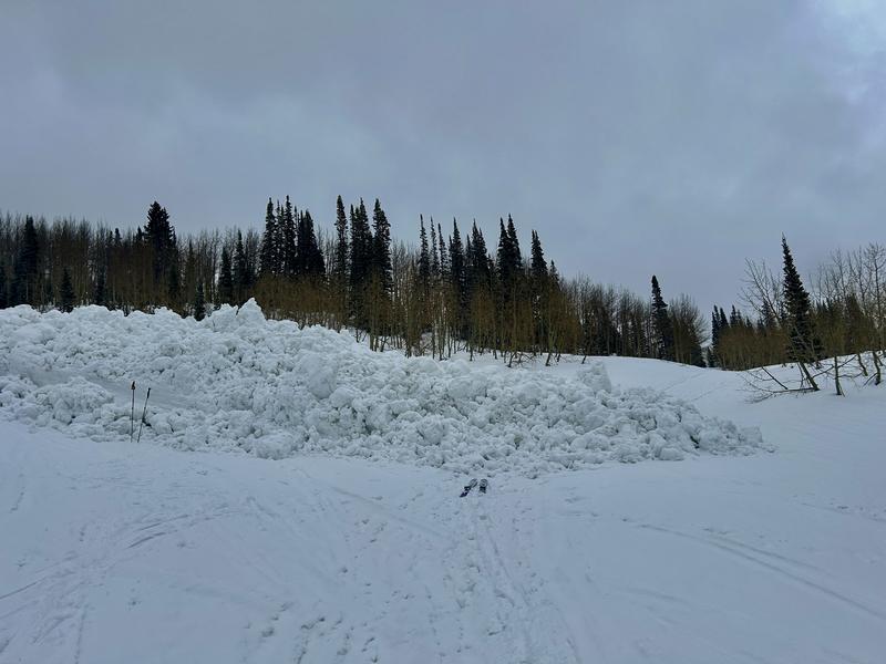
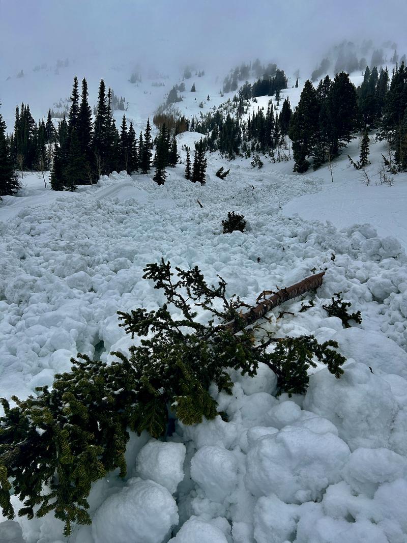
Wet avalanches have been the primary problem for awhile.
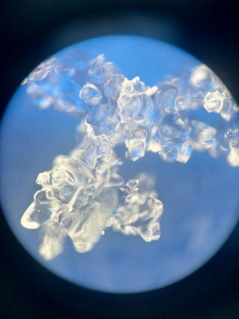
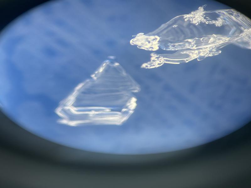
There's a tricky balance with the melt-freeze diurnal cycle in the snowpack. A "little" water in the snowpack can be a good thing. Take two vinyl records or pieces of plastic and put them together and let go of one: they fall apart. Add a touch of water and the surface tension with the water holds them together.
Add too much water (heavy rain) or significant melt, particularly without a refreeze and you've introduced too much water into the snowpack (or earth) and avalanches (or landslides) can occur.
March 20, 2024 Flagstaff Gully (strong sun and warm temperatures)
August 1, 2023 Flagstaff Gully (heavy rainfall)
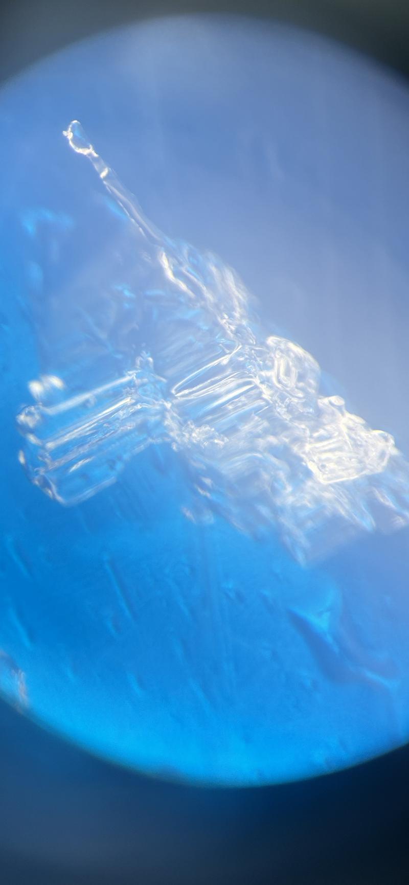
Note the closeup of the melt freeze grain(s)
Mostly out looking at snow surfaces ahead of Saturday's storm.
I did not find any weak snow on solar aspects.
On a north facing aspect at 10,300', I found a thin grey line of buried surface hoar; now buried 2" deep. It is preserved now by today's 1-2" of snow and may(?) be found only in localized terrain. It will be something to look for tomorrow (Friday) to see how widespread this layering is. If it's more widespread than expected and we see a good snowfall/wind event, there'll be trouble.
Today's Observed Danger Rating
Low
Tomorrows Estimated Danger Rating
None
Coordinates