Observation: Laurel Highway

Observation Date
3/13/2024
Observer Name
Garcia
Region
Moab » Laurel Highway
Location Name or Route
Laurel Highway to Gold Basin
Weather
Sky
Overcast
Precipitation
Moderate Snowfall
Wind Direction
West
Wind Speed
Light
Weather Comments
Skies were overcast this morning with S2 snowfall until about 1 PM. 6 inches total accumulation. The skies eventually cleared late in the day. Solar aspects received about 2 hours of full sun at the end of the day. Light West winds on the ridge tops, barely a whisper of wind down below the ridgelines. I did not observe any snow transport today.
Snow Characteristics
New Snow Depth
6"
New Snow Density
Medium
Snow Surface Conditions
Powder
Snow Characteristics Comments
6 inches of new snow at 0.7" SWE. The mountains got a much needed refresh and today was a great day. I found really fun "dust on crust" conditions on the solar aspects, and soft shallow powder skiing on the Northerlies.
I spent the day hunting around for the weak layer of snow responsible for the small skier-triggered avalanche on Tuesday. I am happy to say I was unable to find this layer as I dug a bunch of shallow pits around Julie's Backside, Prelude, Near Coyote Chute, in Funnel Trees, Showoff, and below the Snaggletooth Chutes. The weak layer in question is really spotty in its distribution. It should remain on everyone's collective radar at least through the next loading event. We should get a good shot of snow Thursday night through Friday and into Saturday. If this weak layer is going to produce any more avalanches, it will be during the upcoming storm. The distribution is so spotty, that I am not ready to include it in our avalanche problem types. The layer has popped up in steep, sparsely treed, northerly aspects near treeline and below. It is buried about 10" below the surface in areas that are not drifted. This layer is very weak and obvious, and if it exists, you will find it easily by digging a shallow pit. With a decent load, I expect it to produce collapsing and cracking.
Avalanche Problem #1
Problem
Wind Drifted Snow
Problem #1 Comments
I observed no blowing and drifting snow today. Winds were remarkably calm. As I write this, the NW winds are starting to pick up into the moderate range, which means they are sadly starting to blow and drift the new snow.
Snow Profile
Aspect
Southwest
Elevation
11,300'
Slope Angle
31°
Comments
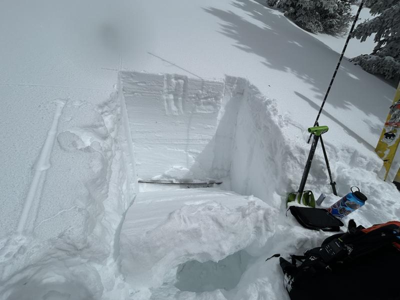
I dug a pit on Showoff to check in on Westerly aspects. This pit was WSW (239 degrees). There are a lot of layers here, but the main take-home point is that this is a strong snowpack. After conducting an ECT, I was able to pull out the entire column of snow as a cohesive block, top to bottom, including the rounding depth hoar at the base of the pack. This is seen in the photo below.
Today's Observed Danger Rating
Moderate
Tomorrows Estimated Danger Rating
None
Coordinates