icon-add
Observation
Menu
×
Menu
Forecasts
Logan
Ogden
Salt Lake
Provo
Uintas
Skyline
Moab
Abajos
Weather
Archives
How to read the forecast
Observations & Avalanches
Submit Observation
NEW - Observations Explorer
All Observations
Avalanches
Fatalities
Place Names Map
Archives
Education
Avalanche Awareness
Develop Skills
On-Snow Courses
Resources and Tutorials
Events
Store
About
Contact
Who we are
Core Values
Staff
Board of Directors
Past Forecasters
Sponsors
Annual Reports
Sign In
Blog
Donate / Join
Search
Forecasts
Logan
Ogden
Salt Lake
Provo
Uintas
Skyline
Moab
Abajos
Weather
Archives
How to read the forecast
Observations & Avalanches
Submit Observation
NEW - Observations Explorer
All Observations
Avalanches
Fatalities
Place Names Map
Archives
Education
Avalanche Awareness
Develop Skills
On-Snow Courses
Resources and Tutorials
Events
Store
About
Contact
Who we are
Core Values
Staff
Board of Directors
Past Forecasters
Sponsors
Annual Reports
Sign In
Blog
Menu
Search
icon-add
Observation
Donate / Join
Submit Observation
NEW - Observations Explorer
All Observations
Avalanches
Fatalities
Place Names Map
Archives
Submit Observation
NEW - Observations Explorer
All Observations
Avalanches
Fatalities
Place Names Map
Archives
Observation: Mill Hollow
Observation Date
3/13/2024
Observer Name
Schumacher
Region
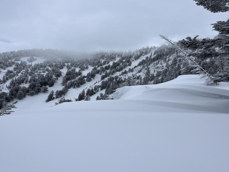
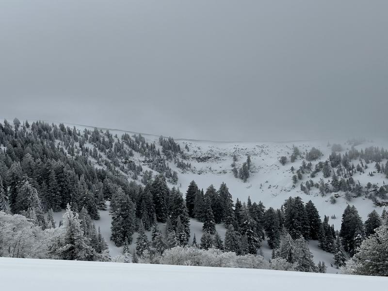
Logan » Logan Dry Canyon » Mill Hollow
Location Name or Route
Logan Peak, Logan Dry to Mill Hollow
Weather
Sky
Broken
Precipitation
Light Snowfall
Wind Direction
Northwest
Wind Speed
Light
Weather Comments
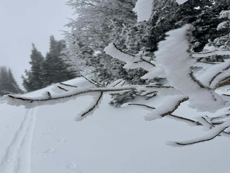
Generally Broken skies with alternating short periods of sunshine and very light snowfall (no accumulation) throughout the day. Light NW winds with periods of moderate. Above about 8500', skies were obscured and visibility was poor as the cloud ceiling was around 8000-8500'. However this obscured cover was in and out with short periods of increased visibility throughout the day. Air temperature was noticeably colder above about 7500'.
Snow Characteristics
New Snow Depth
3"
New Snow Density
Low
Snow Surface Conditions
Powder
Wind Crust
Melt-Freeze Crust
Snow Characteristics Comments
Estimated 0.5" new snow near the dry canyon TH and at low elevations increasing to about 3-4" of new snow at upper elevations with some small graupel noted on top. New snow was significantly drier above about 7500' on ascent and the snow at upper elevations was dry and light and increased in moisture and density as we descended. At upper elevations, the snow surface was more variable with windward areas buffed and leeward areas loaded with soft drifts and wind skins and large cornices. The 8000-8500' elevation band seemed to hold the most snow in this area from this exiting storm. Generally, new snow was sitting on a supportable 1-3" melt freeze crust that was capping about 6-12" of dry to moist snow on a stout crust below. This surface crust varied with westerly aspects having a more breakable and thinner surface crust and a wind skin on the new snow, lower elevations in Mill hollow had a very breakable decomposing crust by mid day that made travel difficult, and upper elevation northerlies had a supportable crust that was bondning well to the new snow.
Red Flags
Red Flags Comments
No red flags noted. Stability appeared very good throughout the day.
Today's Observed Danger Rating
Low
Tomorrows Estimated Danger Rating
Low
Coordinates