Observation Date
2/25/2024
Observer Name
Magerl
Region
Skyline » Birch Creek
Location Name or Route
South Skyline
Weather
Sky
Clear
Wind Direction
West
Wind Speed
Moderate
Weather Comments
Sunny and warm. Afternoon gusts in the 20 mph range.
Snow Characteristics
Snow Surface Conditions
Dense Loose
Wind Crust
Melt-Freeze Crust
Damp
Snow Characteristics Comments
A large menu of damaged snow options. Sastrugi up on the ridgeline, breakable crust on west-facing at 9,500 feet, a few turns of recrystalized in the NW-facing pines at 9,100 feet and damp snow at 8,800 feet.
Red Flags
Red Flags
Wind Loading
Red Flags Comments
The forecast for hours of gusts in the 30 mph range Monday is an attention getter. Despite the warmth, crust and heavy snow, the winds were finding very fine sand-like grains somewhere and they were easily transported Sunday afternoon. This afternoon the wind was constant from the west on the South Skyline ridgeline, swirling but not oppressive 1,000 feet below the ridge. Winds tomorrow will increase the danger before the new snow falls.
Snow Profile
Aspect
Northwest
Elevation
9,200'
Slope Angle
33°
Comments
Dug a pit on 33 degree NW facing at 9,200 feet. Total depth 180 cm, graupel layer 15 cm down. A 4F weak layer about 100 cm down, then back to 1F/P. Final 40 cm loose grains, but gaining strength. ECTN. Almost impossible to budge when trying to force a collapse of the column. Finally broke with no energy on the 4F layer 100 cm down.
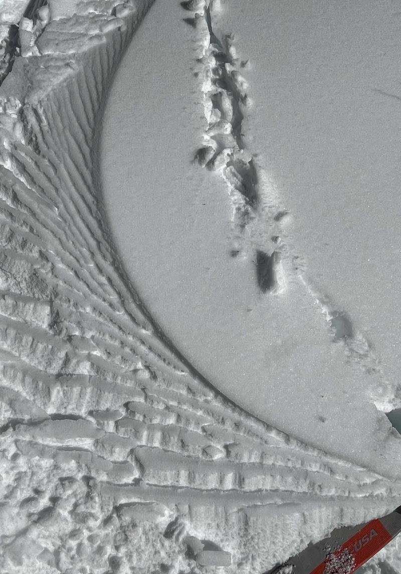
Shark-gill-pattern turns at 8,800 feet, NW facing. The snow is damp.
Today's Observed Danger Rating
Low
Tomorrows Estimated Danger Rating
Considerable