Observation: Park City Ridgeline

Observation Date
2/19/2024
Observer Name
Malone
Region
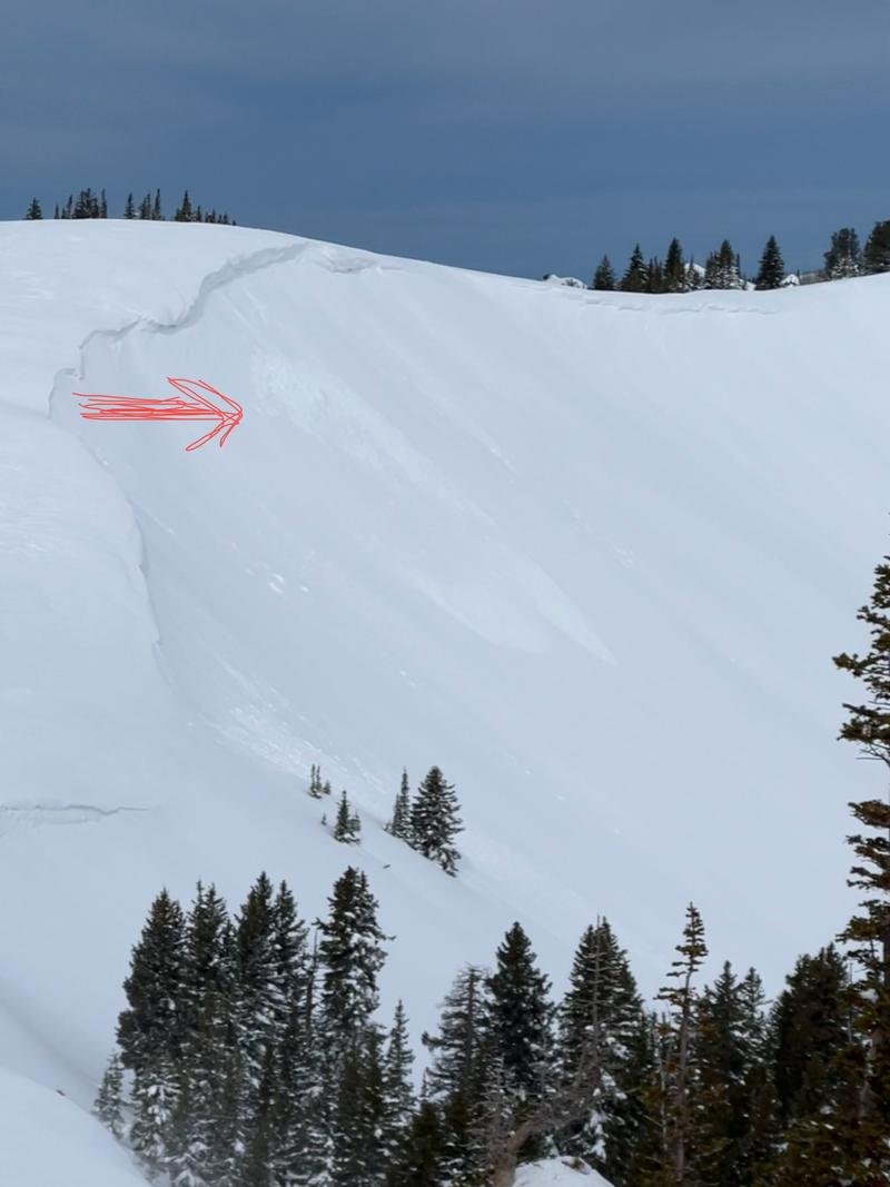
Salt Lake » Park City Ridgeline
Location Name or Route
PC ridgeline
Red Flags
Red Flags
Recent Avalanches
Wind Loading
Cracking
Collapsing
Rapid Warming
Poor Snowpack Structure
Avalanche Problem #1
Problem
Wind Drifted Snow
Trend
Increasing Danger
Problem #1 Comments
Impressive transport of snow by moderate to strong S then W winds throughout the day today, with winds ramping up to strong westerly in the afternoon. Pluming and flagging visible on all peaks (see video below of Scott Hill). Saw what looked like natural cornice fall triggered D1 in South Monitor (see photo). Ski cut a D1 wind slab on a NE slope at 9700', 10 cm deep and 30' wide, ran 200'. Tonight's storm will likely bury the wind slabs created today, making them a little less obvious and possibly pushing hazard to high with wind slab and storm slab.
Avalanche Problem #2
Problem
Persistent Weak Layer
Trend
Same
Problem #2 Comments
The crust facet combo from the Valentine's Day storm was easily felt on SE slopes. We had two loud collapses on this layer on a SE facing slope at 9500'. A quick hand-pit shows a stout MF crust w fine grain facets (0.5 mm) on top, about 20 to 30 cm down. It will be interesting to hear if this later is active with the new snow tomorrow, or if today's warmth was enough to help it start healing. Lots of uncertainty for me around this layer, including its distribution, but it should remain easy to find with a little digging.
Video
Today's Observed Danger Rating
Considerable
Tomorrows Estimated Danger Rating
High
Coordinates