

Observation Date
2/15/2024
Observer Name
Gagne
Region
Salt Lake » Little Cottonwood Canyon
Location Name or Route
Upper LCC Periphery & White Pine
Comments
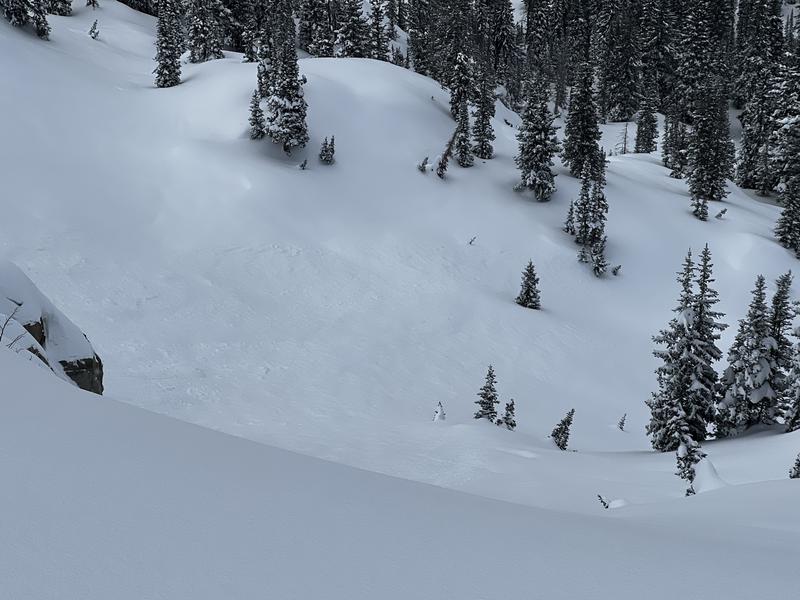
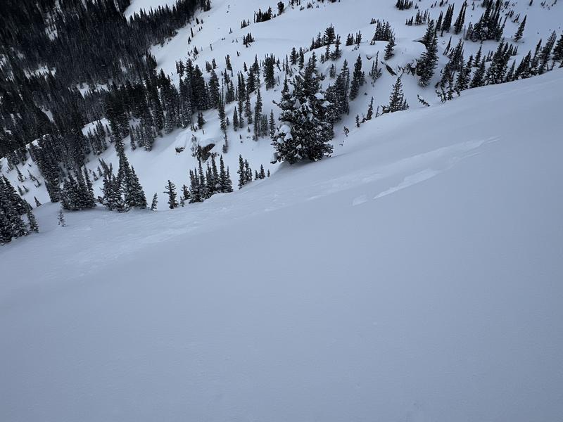
Afternoon tour in upper LCC periphery as well as some time at White Pine to look at low elevation snow. Upper LCC went through a natural cycle at some point during the afternoon, and I noticed a few small crowns from natural avalanches. (Photos below.)
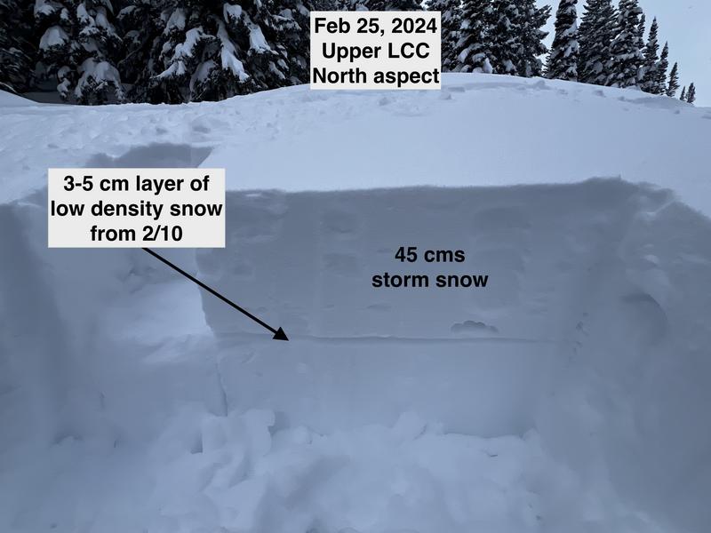
I dug several pits looking at the top 30-60 cms of snow since Wednesday. In areas that were not wind-drifted, instabilities with the storm snow had settled out and I could not get clean shears within the storm snow or at the interface of the old snow surface. But, once the slab had some wind-drifted snow, I was getting full propagation with extended column tests down 45 cms in the layer of low-density snow that fell late Saturday afternoon. (Photo below.) With one pit, I even got ECTPV where it failed upon isolation. For Friday, I would watch for any new or recent wind-drifting as the layer of low-density stellars from Saturday is likely to still be reactive.
Photos of a couple of natural avalanches that ran during a period of intense snowfall Thursday afternoon. Judging by the depths of the crowns, these all likely ran on density inversions within storm snow.
Significantly less snow at low elevations. Avalanche danger for Friday will be elevation-dependent, with the greatest avalanche danger on wind-loaded slopes at the upper elevations.
Today's Observed Danger Rating
Considerable
Tomorrows Estimated Danger Rating
Considerable
Coordinates