Observation Date
2/14/2024
Observer Name
Hardesty and Diegel
Region
Salt Lake » Parleys Canyon
Location Name or Route
Parley's Burn
Weather
Sky
Scattered
Wind Speed
Calm
Snow Characteristics
New Snow Depth
2"
New Snow Density
High
Snow Surface Conditions
Powder
Damp
Snow Characteristics Comments
Solars and low elevation snow became damp with sun/warming.
Red Flags
Red Flags
Poor Snowpack Structure
Red Flags Comments
We did not experience any cracking or collapsing in our travels. A "poorer" snow structure than expected. See below.
Avalanche Problem #1
Problem
Wind Drifted Snow
Trend
Decreasing Danger
Problem #1 Comments
While we saw little to no wind damage/loading up high, winds from the southwest from 2/13/24 preferentially cross-loaded terrain well off the ridgelines. See photos below of wind drifted snow and the subsequent nasty ride below.
Avalanche Problem #2
Problem
Persistent Weak Layer
Trend
Same
Problem #2 Comments
Frequent probing yielded a fairly consistent picture just above and just below 8000' on shady aspects (note that top of the ridgeline is 8200'): Total depths of 100-130cm with 20-30cm depth hoar at the base of the pack. See profile. Despite the ECTXs, I did not like the structure and opted to remain on low angle slopes. Ski tracks noted, however, in steep terrain w/o incident. Photo of depth hoar below.
Snow Profile
Aspect
Northwest
Elevation
7,800'
Comments
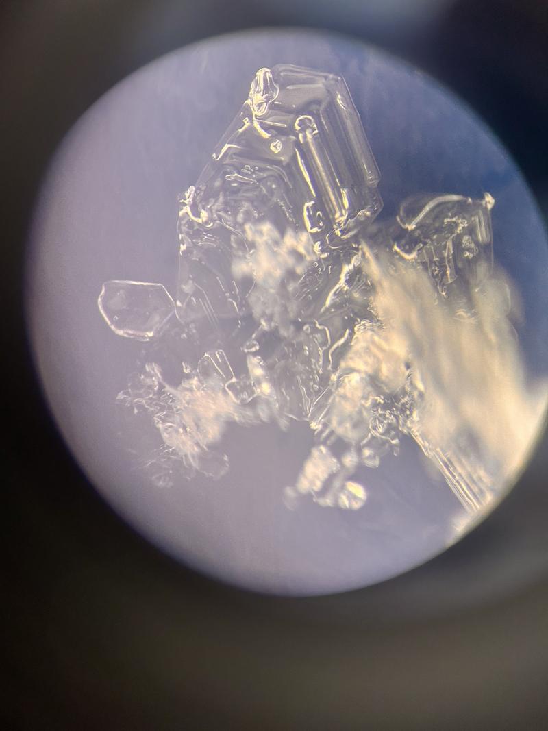
Surface hoar and facets formed over the weekend and early week are now buried in some locations by the Valentines Day "storm". 5mm SH noted intact along the ridglines and below 8000'. It did take some 'teasing out' below the new stellars but it is present in nearly all the places we looked. Some was laying over, some was not. This should be on the radar with upcoming storms.
Today's Observed Danger Rating
Moderate
Tomorrows Estimated Danger Rating
None
Coordinates