Observation: Middle Cirque

Observation Date
2/13/2024
Observer Name
Charlie R, Dave G, Wyatt
Region
Moab » Gold Basin » Middle Cirque
Location Name or Route
Tuk N Ridge
Weather
Sky
Clear
Wind Speed
Calm
Weather Comments
Third sunny day that the surface snow has seen. Very minimal winds since storm.
Snow Characteristics
Snow Surface Conditions
Powder
Melt-Freeze Crust
Snow Characteristics Comments
Cold, northish aspects still have soft snow on them and excellent sliding conditions. Even surfanes that looked wind affected that we came across were soft and skied like powder conditions.
Avalanche Problem #1
Problem
Persistent Weak Layer
Trend
Same
Problem #1 Comments
Enter the rabbit hole.
Let's zoom out first. Our snowpit was 200cm deep!! Not only that, but from top to bottom it was showing signs of strength. Woohoo!
Let's zoom in. Sheesh, I could write 1000 words on this. One thing that impressed me was the lack of hardness difference from layer to layer throughout the snowpack, this is a good thing if you like a strong pack. Even the least cohesive facets at the ground are starting to round out and stick to their friends! The snowpack is littered with subtle crusts and layers of snow going from rounds to facets and facets to rounds. We had to really look hard at the snow crystals to decipher what the grain types were in some of these layers. Layers like this could become layers of concern if the TG in that zone continues to promote facet growth. We will have to see what happens as time goes on. One place this is happening enough to mention is beneath the 'styrofoam' snow event. That snow was/is so cohesive that it is crust-like on the bottom and therefore a good habitat for the percolating water to stop and affect those crystals - faceting. How the facet/round crust sandwiches in the upper part of the snowpack trend will really affect how long our PWL problem will continue.
We expected our snowpit location would have some of the deepest snow observed recently in Gold Basin. It was, and this snow depth is certainly more isolated than found on an average N face above or near treeline. Deep snowpack can stabilize the TG and create a stronger snowpack. Additionally it is way harder to trigger an avalanche when the weak layer is so far down. Most other areas will hold less snow, may have a weaker pack, and be easier to trigger. So the PWL and avalanche problem remains complicated and tricky.
Snow Profile
Aspect
North
Elevation
10,700'
Slope Angle
33°
Comments
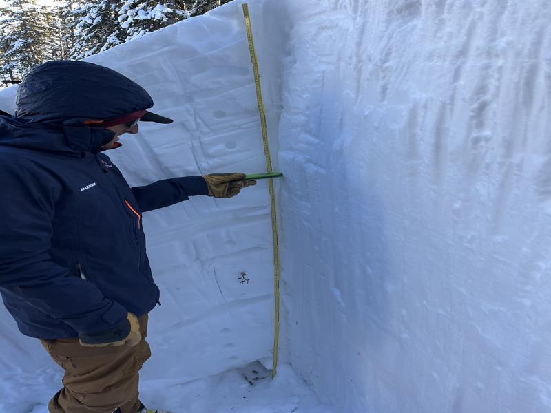
You can see how deep our snowpit was. The hardness testing isn't really clear in the photo, but so much of the snow is 1F and well bonded.
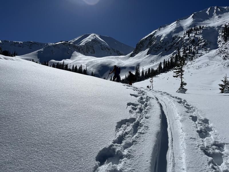
People found excellent skiing on S and SW aspects over the weekend. Those snow surfaces have changed and if you're wanting to hunt for soft snow, you'll be looking towards the colder slopes.
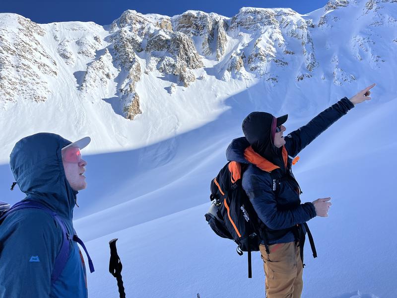
Be careful! We do have this 'stability trend' happening right now. Our party, as well as others have been stepping out into terrain and been willing to be exposed to potential hazard. The photo here is one of the many assessments we did throughout the day to justify our travel plan. Careful and thorough snowpack analysis and an understanding of your parties risk tolerance is vital to making decisions that will have positive outcomes.
The recent avalanches in Gold Basin have reminded us so much of how subtle aspect and steepness can be. Particularly in the Funnel, easy to think that is just a SW aspect, but the NW terrain trap at the bottom recently avalanched. Complex terrain like this can catch us off guard. If you're considering stepping out, look for simple terrain with clean runouts.
Today's Observed Danger Rating
Considerable
Tomorrows Estimated Danger Rating
Considerable
Coordinates