icon-add
Observation
Menu
×
Menu
Forecasts
Logan
Ogden
Salt Lake
Provo
Uintas
Skyline
Moab
Abajos
Weather
Archives
How to read the forecast
Observations & Avalanches
Submit Observation
NEW - Observations Explorer
All Observations
Avalanches
Fatalities
Place Names Map
Archives
Education
Avalanche Awareness
Develop Skills
On-Snow Courses
Resources and Tutorials
Events
Store
About
Contact
Who we are
Core Values
Staff
Board of Directors
Past Forecasters
Sponsors
Annual Reports
Sign In
Blog
Donate / Join
Search
Forecasts
Logan
Ogden
Salt Lake
Provo
Uintas
Skyline
Moab
Abajos
Weather
Archives
How to read the forecast
Observations & Avalanches
Submit Observation
NEW - Observations Explorer
All Observations
Avalanches
Fatalities
Place Names Map
Archives
Education
Avalanche Awareness
Develop Skills
On-Snow Courses
Resources and Tutorials
Events
Store
About
Contact
Who we are
Core Values
Staff
Board of Directors
Past Forecasters
Sponsors
Annual Reports
Sign In
Blog
Menu
Search
icon-add
Observation
Donate / Join
Submit Observation
NEW - Observations Explorer
All Observations
Avalanches
Fatalities
Place Names Map
Archives
Submit Observation
NEW - Observations Explorer
All Observations
Avalanches
Fatalities
Place Names Map
Archives
Observation: Navajo Point
Observation Date
2/9/2024
Observer Name
Ian Dempsey
Region
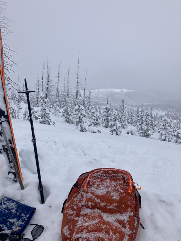
Southwest » Brian Head Backcountry » Navajo Point
Location Name or Route
Navajo Point
Weather
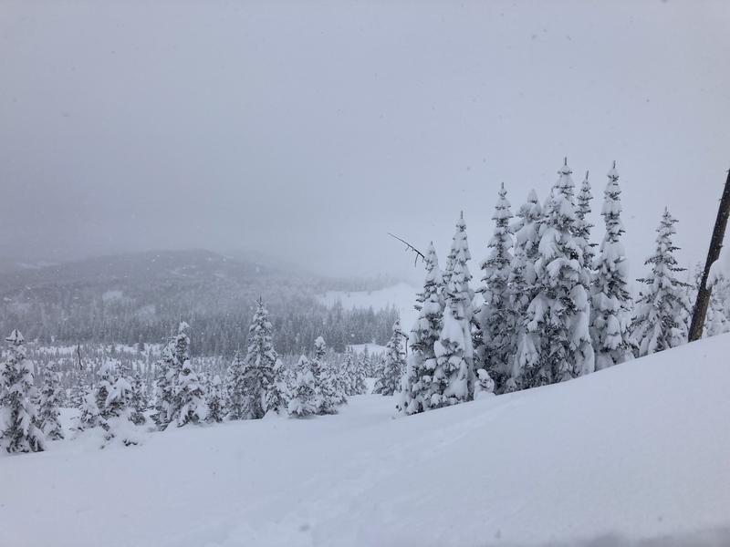
Sky
Overcast
Precipitation
Light Snowfall
Wind Speed
Calm
Weather Comments
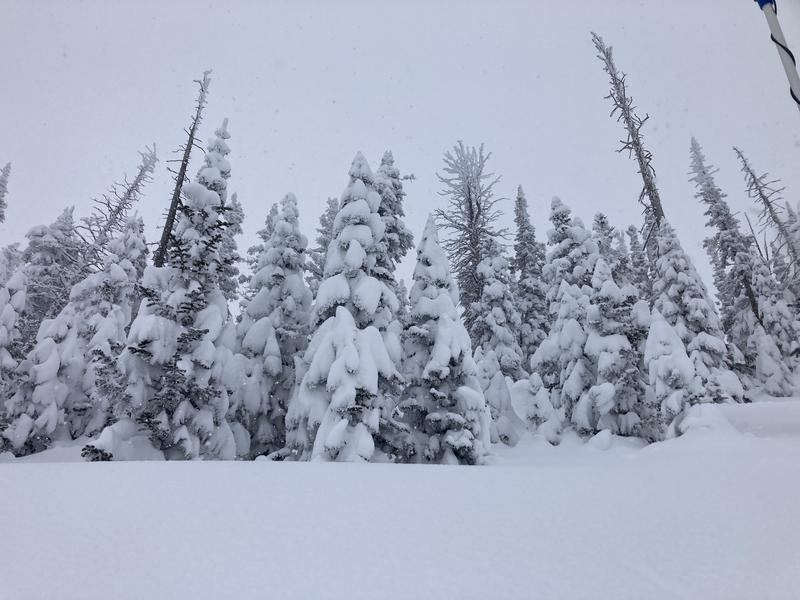
Cold temps in the teens and light to moderate snow.
Snow Characteristics
New Snow Depth
10"
New Snow Density
Low
Snow Surface Conditions
Powder
Snow Characteristics Comments
This area received about 30 inches of new snow in the last 3 days. This recent snow is right side up and travel is relatively easy despite the quantity of the new snow.
Red Flags
Red Flags
Heavy Snowfall
Wind Loading
Poor Snowpack Structure
Red Flags Comments
Without the cracking and collapsing we had 2-3 weeks ago, we have a false sense of security out there. The heavy load of new snow (looks like about 2" SWE), recent wind loading, and poor structure are reason to be cautious.
Avalanche Problem #1
Problem
New Snow
Trend
Decreasing Danger
Problem #1 Comments
About 30" in the Brian Head area since Tuesday. Forecast to get another 1-2" tonight before things quiet down. No new snow avalanches were witnessed. No cracking or collapsing were witnessed. The only instability witnessed in these new snow layers was in my compression test. However, this is a single snow pit and a single observation. I'm not sure how the new snow is behaving in other areas.
Avalanche Problem #2
Problem
Persistent Weak Layer
Trend
Same
Problem #2 Comments
It's still out there. I'm reading from others more experienced than myself that it is healing but that it will take more time. Things seem more stable because we don't have any of the obvious red flags associated with this layer, but it's a 'sleeper'. In other words, hit it in the right spot and I expect it to fail in a big way.
Snow Profile
Aspect
North
Elevation
10,500'
Slope Angle
25°
Video
Today's Observed Danger Rating
High
Tomorrows Estimated Danger Rating
Considerable
Coordinates