Observation Date
1/16/2024
Observer Name
Bruce Tremper
Region
Salt Lake » Big Cottonwood Canyon » Mill D North » Butler Fork » Reynolds Peak
Location Name or Route
Reynolds Peak
Weather
Sky
Clear
Wind Speed
Light
Snow Characteristics
New Snow Depth
10"
New Snow Density
Medium
Snow Surface Conditions
Dense Loose
Wind Crust
Snow Characteristics Comments
Surface snow is quite wind blasted at upper elevations from the extremely strong west through northwest wind these paset few days. In more wind sheltered locations it's dense, rimed snow, which along with the cold temperatures make it a bit slow. But turning conditions are actually quite good on wind sheltered slopes, sinking in about 10 inches into dense snow.
Red Flags
Red Flags
Recent Avalanches
Heavy Snowfall
Wind Loading
Poor Snowpack Structure
Red Flags Comments
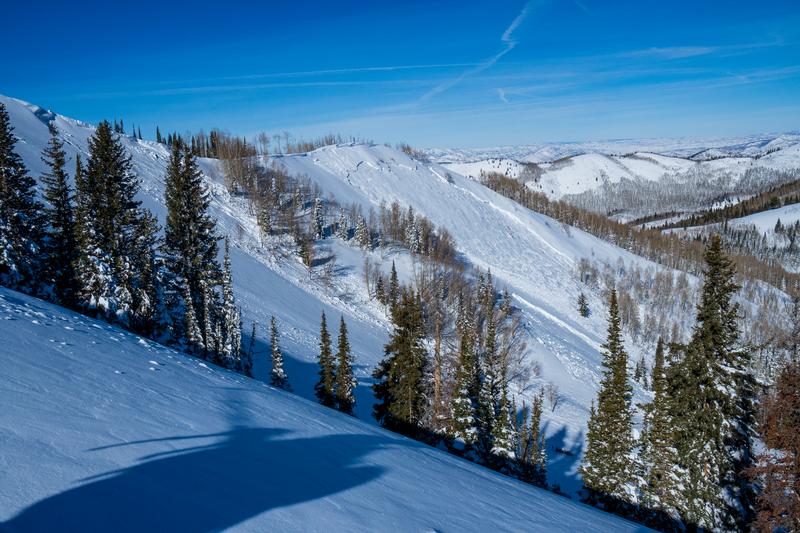
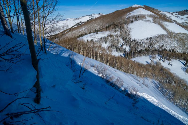
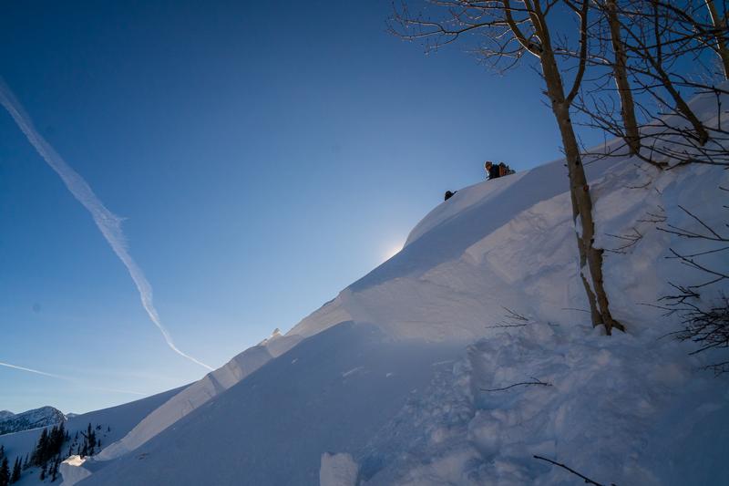
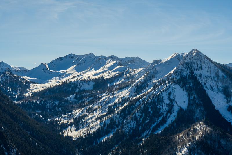
I can seldom resist getting out on bluebird days after a huge storm with widespread avalanche activity to do some avalanche sightseeing and nerding. The avalanches are unusually widespread and most of these have been previously reported. The most unusual part of this widespread cycle is the number of avalanches on southerly facing slopes. For instance, much of the south face of Gobbler's Knob has avalanched but they look more shallow than the bigger, deeper avalanches on the more shaded aspects, South aspects seem to be breaking about 1-2 feet deep, perhaps new, wind drifted snow on a sun crust but I was not able to confirm this. The more shaded aspects are mostly running on the well-advertised, faceted snow on the surface before this latest round of snow--80 inches in favored areas with a wallop of very dense snow and wind toward the end, which pushed everything hopelessly over the edge. As previously reported, there was a photogenic avalanche on the east-southeast facing east shoulder of Reynolds Peak, which broke 2.5-3 feet deep and about 200 feet wide both up to the spur ridge and propagated in other areas lower on the slope making it even wider. The main bowl did not slide deep but it had an older, shallower new snow avalanche on it, which is now mostly covered by wind drifted snow. I was able to safely access the upper crown face of the main slide and dug a quick few profiles along the crown face. It's a classic setup with most of the season's snowpack sliding on the very weak depth hoar near the ground. In this case, the weakest layer was perhaps 30 cm off the ground and sandwiched between some weak, ice crusts and was about 10 cm thick. It was extremely tender and I could easily shove my arm into it up to my armpit. No wonder it was not able to support all the weight of the copious new snow above it. I should mention that I was just as impressed with what did not slide as what did. Places like God's Lawnmower seemed intact, while just east of it, on Kesler Slabs had slid wall to wall probably early in the storm. The entire bowl of Wilson Chutes slid and I could only get a glimpse into Alexander Basin, where I imagine everything probably slid, as it often does in these conditions. The bottom line is that even though this was a very widespread avalanche cycle, there is still a LOT of slopes that remain hanging in the balance like a giant rat trap straining against a hair trigger. Personally I'm not venturing onto slopes steeper than 30 degrees and not locally connected to steeper terrain, especially above. If you just have to get onto something steep, wait for new snow on an old avalanche surface. With more snow--and weight--forecast, these persistent weak layer will require equally persistent patience, as the old expression goes.
Snow Profile
Aspect
Southeast
Elevation
9,200'
Slope Angle
38°
Comments
Three photos of the Reynolds Peak avalanche and crown face. Another looking up Cardiff Fork with Kesler Peak on the right. Notice slide in Kesler Slabs and possibly Catcher's Mitt, but God's Lawnmower still seems intact. But from a distance it's uncertain.
Today's Observed Danger Rating
High
Tomorrows Estimated Danger Rating
High
Coordinates