

Observation Date
1/16/2024
Observer Name
Erik Fullmer
Region
Provo
Location Name or Route
Aspen Grove
Comments
Weather: The morning started cold at 4*F. The wind was calm in my terrain (6880-8700') and I observed the occasional light-moderate swirling winds on ridgelines (10k+). Skies were clear during my tour. Temperature at the trailhead (on the way out) at 1130 was 21*F. BEAUTIFUL day.
A wonderful day to get out and see the natural avalanches and to assess the snowpack. Below are photos of naturals as well as a photo of pit #1 and a video of pit #2. I was impressed by the settlement of approx. 120cm of new snow. New snow measuring at 50-65cm in observed zones. In the video you can see plenty of 1F hardness new snow.
The skiing was surfy and a bit grabby but fun! It was really nice to finally not be constantly hit by branches in the face in this zone :)
I think danger was Considerable in this zone today. The zone is low elevation up to 8900'. A factor to consider is the skier and skinner compaction in this high traffic but small area. Also, a lot of the solars in the zone harbored basically no snow before this storm.
Video below of Pit #2: NNE 8450' - meadow collapsed when I stepped out of my skis and broke through the new snow into the faceted snow. ECTP22 65cm down at the new snow/old snow interface. Watch the video to see the energy of the column. Although it's 65cm of new snow on top, it's quite a heavy 65cm of snow.
- Photo 1: Avalanche on SE aspect at 10,000'. Looks to have happened approx. Saturday night, covered by new snow.
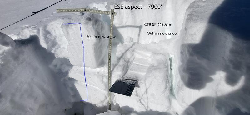
- Photo 2: Pit #1 on SE aspect 7900'. CT9 SP down 30cm within the new snow. HS: 80cm. New snow: 50cm. The weak layer was a density inversion, most likely the VERY wet snow event Saturday night into Sunday.
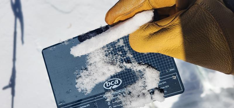
- Photo 3: top of density inversion where the CT9 SP failed.
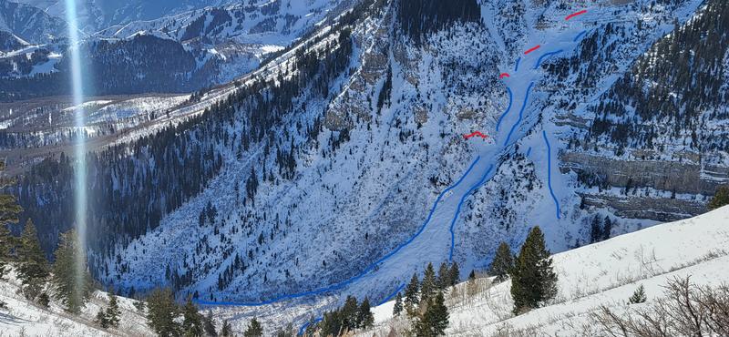
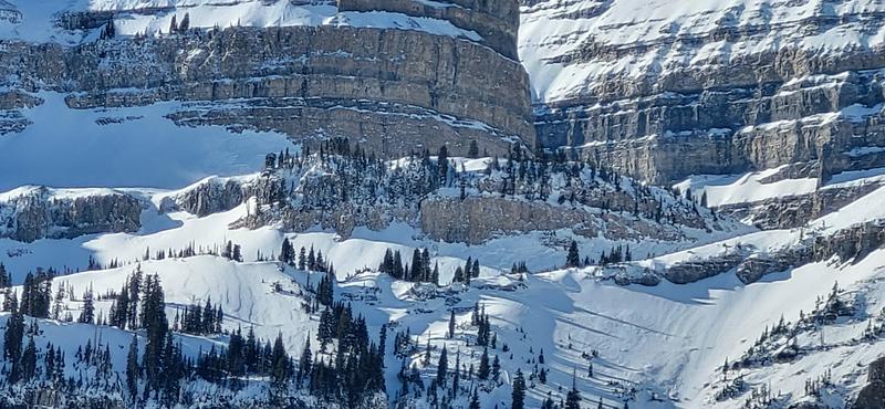
- Photo 4: Drew Hardesty's reported avalanche from Sunday. I had trouble eyeing the top of the avalanche, but Drew reports 10,400' as the start zone. That means a vertical of over 3000'! And that would explain the extremely deep debris. I'm not sure if it crossed the frequented zone for hikers up Primrose. Remember, this is the zone where 5 people were carried, 3 fatalities of unsuspecting riders in 2003.
- Photo 5: Avalanche on SE aspect, approx. 10,000'. This is just west of Photo 1. Looks to have failed on the new snow/old snow interface.
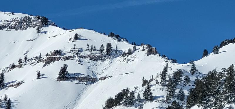
- Photo 6: Obvious wind loading in Primrose Cirque. Upper elevation zone.
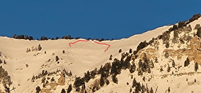
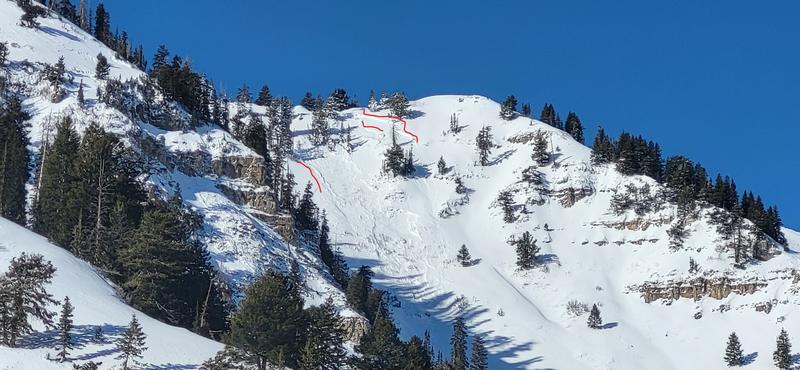
- Photo 7: Avalanche UFO Bowl #2 (middle bowl) on East aspect at 10,000'. Upper right looks to have failed within new snow, shortly below (lower red line on right), it looks to have stepped down to the new snow/old snow interface. The rocks would have been a bad time. This is a local's favorite.
Have fun out there!
Video
Today's Observed Danger Rating
Considerable
Tomorrows Estimated Danger Rating
Considerable
Coordinates