Observation: Cone

Observation Date
1/14/2024
Observer Name
Skigan
Region
Salt Lake » Big Cottonwood Canyon » Bear Trap » Cone
Location Name or Route
The Cone
Red Flags
Red Flags
Recent Avalanches
Heavy Snowfall
Wind Loading
Cracking
Collapsing
Poor Snowpack Structure
Avalanche Problem #1
Problem
Wind Drifted Snow
Trend
Increasing Danger
Problem #1 Comments
Our column tests showed wind drifted snow from this weekend's storm is very touchy and only getting worse as more snow and wind is forecasted through the holiday weekend.
Avalanche Problem #2
Problem
Persistent Weak Layer
Trend
Increasing Danger
Problem #2 Comments
The December dry spell PWL got some help from the sun on this particular aspect but it is no-doubt here to stay for a while on more solar protected aspects. This paired with this weekend's large snow accumulations along with strong winds is following the textbook recipe for large natural avalanches. I expect to see the danger increase into this week with this storm tapering off and another cycle coming Wednesday.
Snow Profile
Aspect
East
Elevation
9,000'
Slope Angle
28°
Comments
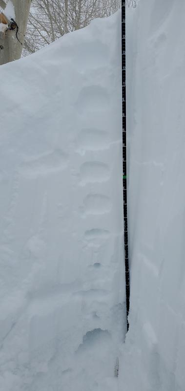
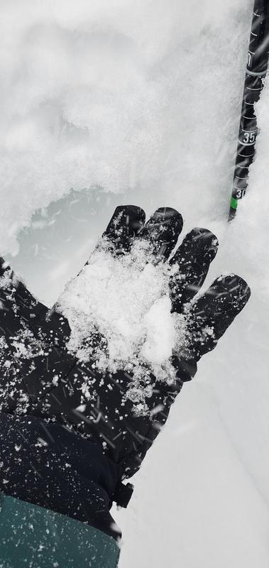
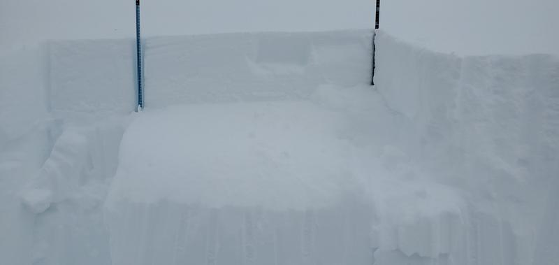
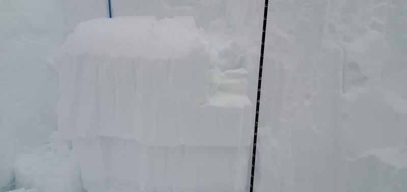
Main concern on this particular aspect is large amounts of wind loading. While the sun helped our December dry spell PWL there's still plenty of evidence of it here not to mention on non-solar aspects or sheltered areas. It was very difficult to get the new snow to fail on this layer but with some help of wind slabs or on an aspect where the layer was more protected, the likelihood of triggering large avalanches is high.
Today's Observed Danger Rating
High
Tomorrows Estimated Danger Rating
Extreme
Coordinates