Observation: Cone

Observation Date
1/10/2024
Observer Name
Talty
Region
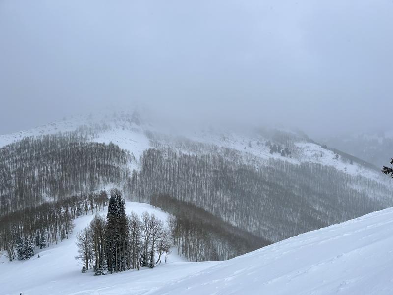
Salt Lake » Big Cottonwood Canyon » Bear Trap » Cone
Location Name or Route
The Cone
Weather
Sky
Overcast
Precipitation
Moderate Snowfall
Wind Direction
West
Wind Speed
Calm
Weather Comments
S2 precip (~2cm/hr) on average, there were brief times of a break in the storm along with brief times of more intense precipitation. Calm winds from the west made for pleasant touring conditions, although gusts occasionally reached moderate speed (~30 mph)
Snow Characteristics
New Snow Depth
6"
New Snow Density
Low
Snow Surface Conditions
Powder
Snow Characteristics Comments
New snow from last night stacked up to 6-8” consistently from the TH to as high as I traveled (9300’). West-facing slopes at mid and upper elevations were nearly stripped of this new snow from last night’s winds. In untraveled areas, snow from the past week felt bottomless underneath my skis. Excellent riding conditions exist on all aspects except due south, where snow still needs to stack up.
Red Flags
Red Flags
Wind Loading
Cracking
Collapsing
Poor Snowpack Structure
Red Flags Comments
Widespread collapses (whumphs) could be felt and heard when walking on previously un-traveled terrain. Small cracks beneath my skis were evident in wind-loaded terrain. Poor snowpack structure was evident before even getting hands in a snowpit, as the December facets jumped out visually while digging.
Avalanche Problem #1
Problem
Persistent Weak Layer
Trend
Increasing Danger
Avalanche Problem #2
Problem
Wind Drifted Snow
Trend
Increasing Danger
Snow Profile
Aspect
Northeast
Elevation
9,300'
Slope Angle
20°
Comments
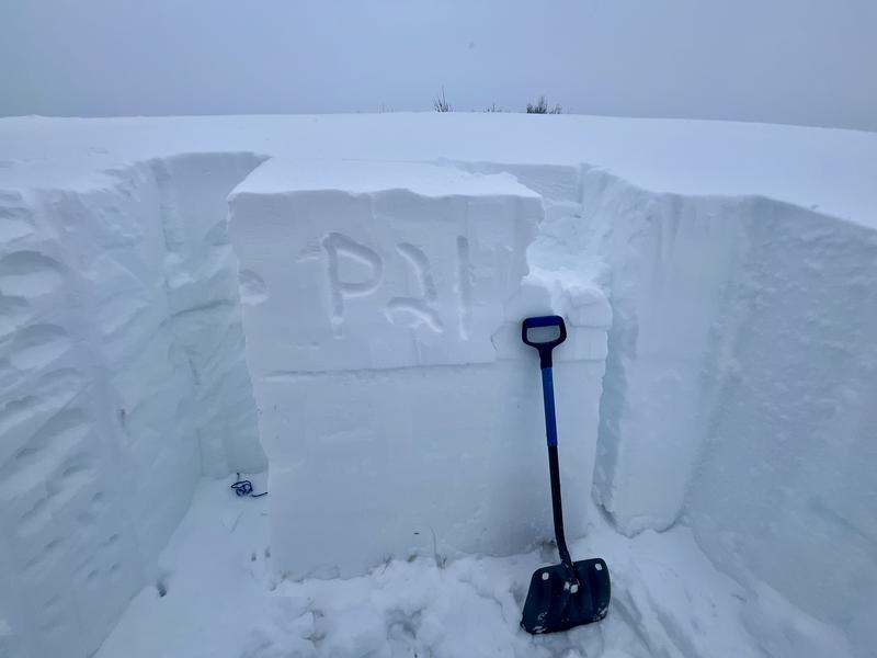
I walked up to the Cone today to investigate slab development over our new PWL formed from December’s dry spell. Snow from last night stacked up to 6” at the TH, with only slightly more at upper elevations. Winds died down from last night and stayed calm from the west, with the occasional moderate gust reaching 30mph. When walking on previously untraveled areas, collapsing (whumping) was easy to find. I dug a snowpit on an NE face at 9300’ in an area I suspected to have a stronger slab above the December PWL. At this location, the height of snow was 130cm, and the December facets were 45cm beneath the surface. Above these facets, new snow from the past week is beginning to gain strength in this wind-loaded location. An extended column test showed propagation on our new PWL (ECTP21 @ 85cm, 45 cm beneath the surface). As the new snow from the past week gains strength, and more weight is added to the upper snowpack, propagation will be easier to produce with less force.
Today's Observed Danger Rating
High
Tomorrows Estimated Danger Rating
High
Coordinates