Observation: Cutler Ridge

Observation Date
1/10/2024
Observer Name
Derek DeBruin
Region
Ogden » Ben Lomond » Cutler Ridge
Location Name or Route
Ben Lomond, Cutler Ridge
Weather
Weather Comments
23F at the trailhead at 0745. Ridgeline summits (Chilly Peak, Ben Lomond, etc.) started to get socked in by 0730, limiting avalanche viewing. Steady S1 snowfall began at the trailhead right on time at 0800 and further limited visibility. This was accompanied by W/SW winds at 10-15mph. By 1000, the storm really started to arrive and PI increased to about S2 with sustained 15+mph winds, gusting to probably 25mph or so. By 1030 my left cheek was no longer up for battling the wind while breaking trail up the ridge. By the time I was back at the car, we'd gotten an average of 1" per hour of snowfall (3" new snow).
Snow Characteristics
Snow Characteristics Comments
Yesterday evening's (20240109) snow squall put about 3-4" of new snow down on top of the weekend (20240106-07) snow. Even at the trailhead, this snow had a thin wind skin, with more significant surface wind effects with both increasing elevation and terrain exposure. Below the wind-affected topping were dense stellars and graupel that mixed down into the top of the 6 January snow, as noted in the 9 January obs.
Unfortunately, though the newest snow was still F hard, the underlying snow was somehow softer (F-), with a density change back to F lower still. This all rested on the facet-coated crust that remains from last week (20240103). Facets on the crust were generally less prominent than a few days ago, difficult to identify as the 6 January snow pressed into them. Facets were generally quite small, 0.5 - 1mm.
This theme was pretty consistent on the N-NE-E aspects I sampled at both low and mid elevations. Photo below. Today's new snow falls atop all of this.
Red Flags
Red Flags
Heavy Snowfall
Wind Loading
Cracking
Collapsing
Poor Snowpack Structure
Red Flags Comments
Many red flags today. Surface reactivity has reduced the last couple days, though a colleague reported CTV and ECTP11 on Cutler yesterday. HOWEVER, I had to leave before the brunt of the storm arrived today, so I'm sure there was more excitement to be had with surface problems as the day advanced. I did get one very small whumpf at my feet near a couple bushes. I also managed to get some soft slab cracking on test slopes (failing on crust) but no significant propagation. Sluffs were possible but didn't seem to dig all the way to the crust. I went hunting for wind exposed terrain and found 4F wind slab (though things were rapidly getting firmer) and kicked off a small slab. This was about 35 degrees steep with a small convexity beneath, so it didn't properly avalanche, but certainly confirmed for me the wind slab/PWL hazard combo in the forecast, to say nothing of new snow problems. Photos below.
Snow Profile
Aspect
Northeast
Elevation
6,900'
Comments
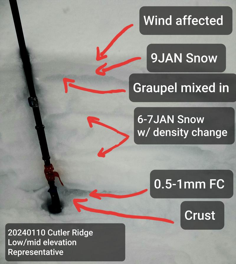
Generally representative upper snowpack profile ca. 5600-7600ft, N-NE-E. This particular image is from NE at 6900ft. Ski pen 30-40cm, as little at 10-15cm in wind exposed terrain.
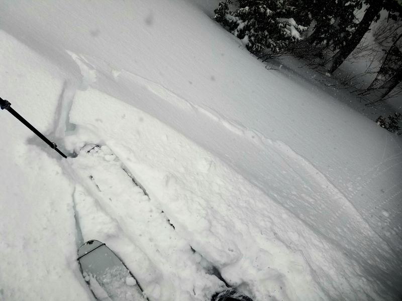
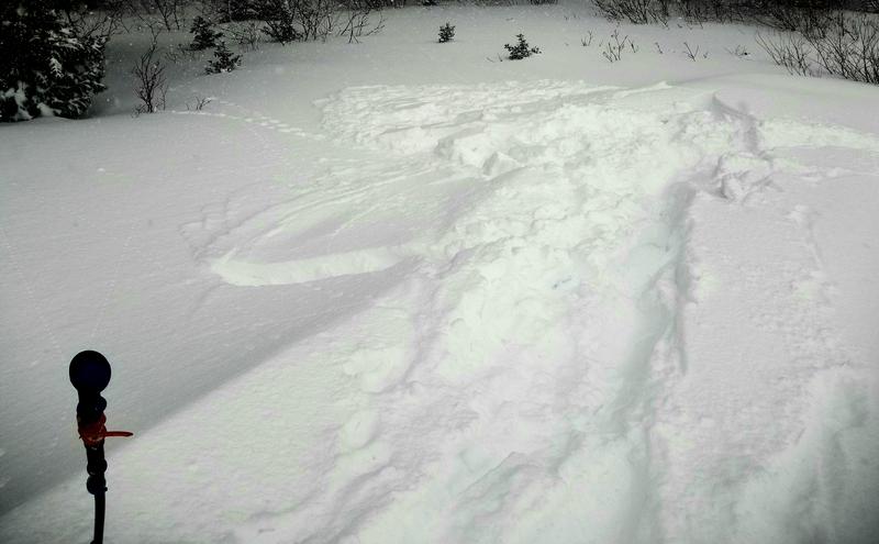
A couple views of cracking/sliding of soft wind slab.
Today's Observed Danger Rating
None
Tomorrows Estimated Danger Rating
None
Coordinates