

Observation Date
4/9/2023
Observer Name
Hardesty and Kelly
Region
Salt Lake » Little Cottonwood Canyon
Location Name or Route
Alta-Snowbird perimeter
Comments
Travel was from Brighton Crest through Lake Martha and Lake Catherine to Catherine's Pass. Continued west through Alta and Snowbird....and return. Keen to see the avalanches in upper LCC, particularly Valeries and Grizzly Cup.
Snow was supportable even on mid-fat skis. This may not have been the case everywhere, particularly on low elevation north. (New wet loose size 1.5 natural on low elevation north facing Outside Corner noted)
Widespread loose wet size 1 and 2 naturals noted over the past couple of days, including today. Only (probable) new wet slab was mid slope south facing Wilson Peak into Butler Basin, probably 2' x 50' wide, south facing at 9500'.
Two large glide cracks noted on NE facing Dromedary Peak. I have not seen these before.
Snow cascading naturally over the Hellgate Cliffs and a natural wet loose avalanche observed over SR 210 in the mid-canyon zone around 230pm and overrunning the gunners right side of the Valerie's avalanche debris from a few days ago around the same time period.
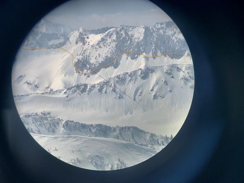
Photo below looking west along the Thunder ridge revealed early week naturals connecting the dots from Montgomery to the Thunderbolt ridge (photo) all east facing at 10,200' and above.
GFS advertises free air temps at 700mb (~10,000') of +3C tonight, +7C Monday night, and +7C Tuesday night.
Many areas in the Ogden and Provo and Park City ridgeline areas will again have a poor refreeze tonight (note current activity), but I do believe that the tri-canyons will be able to *get away with it* tonight, owing to the clear skies.
All bets are off for Tuesday and Wednesday regarding a serious ramp-up in wet activity, owing to the lack of re-freeze.
Wet loose, wet slab, glide, and cornice fall and roof alanches will be certain in many areas...and even mid/high north will get into the action.
Lots of uncertainty owing to the rapid switch from winter to summer, but it should be interesting.
Photo of Runnels on South facing LCC
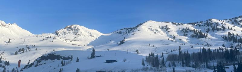
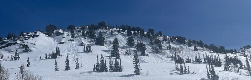
Photo of wet loose on west facing Patsy Marley
Today's Observed Danger Rating
Considerable
Tomorrows Estimated Danger Rating
None
Coordinates