
Observation Date
4/5/2023
Observer Name
Champion, Manship, Talty, Coyne, Collett
Region
Salt Lake » Parleys Canyon » Mt Aire
Location Name or Route
Mt. Aire
Comments
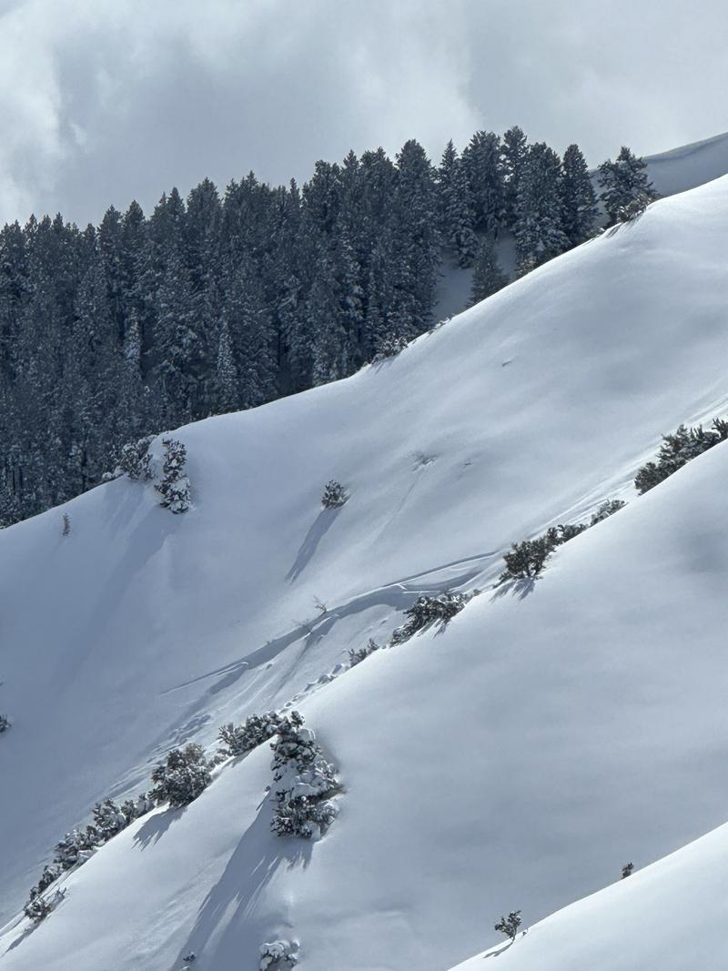
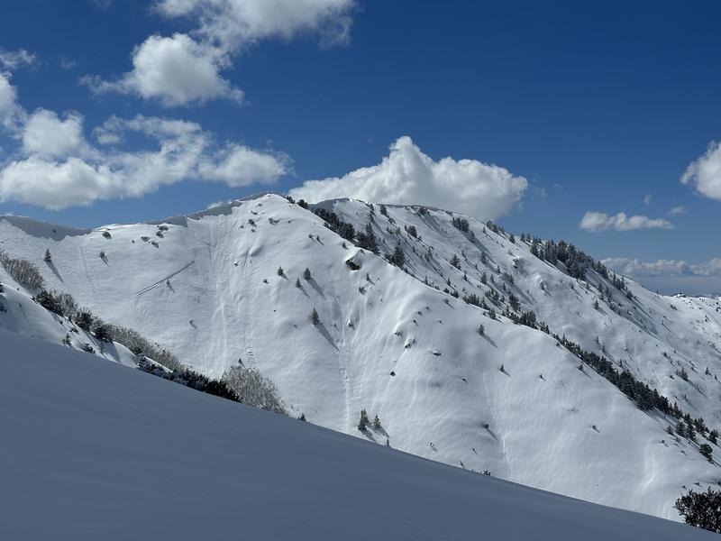
Beautiful tour, excellent to see the sun for the first time in a while. Impressive snow totals from the last storm. There was one supportable isothermal layer from before this storm (likely Saturday), approx 2-3' deep depending on the elevation. This served as the bed surface for most of the recent avalanche activity we noted. Within the new snow, there are multiple density changes from the intermittent breaks in snowfall. One small firmer 3" layer, down approx 12"-18" that the new snow from last night and this morning would easily shear off of. No cracking, or easy sluffing on a few steeper rolls we touched. We were able to get one audible collapse while touring.
The entire area seemed to go through a recent avalanche cycle, with multiple natural and human-triggered avalanches on almost all North, and East facing aspects we could see. Most of these seemed to fail as soft slabs yesterday morning, or during very high PI rates. Sensitivity in the area seemed to be decreasing with the solar, and break-in snowfall, but we did not want to push into any steep terrain, or below any steep terrain.
By the afternoon, the solars had begun taking on a bit of heat and the snow surface was damp in places, and had a bit of a greenhouse crust in others.
A bit of wind texture on the surface.

Avalanches seen throughout the tour.

Today's Observed Danger Rating
None
Tomorrows Estimated Danger Rating
None
Coordinates


