

Observation Date
3/19/2023
Observer Name
CB
Region
Salt Lake » Big Cottonwood Canyon » Brighton Perimeter » Snake Creek
Location Name or Route
Snake Creek
Comments
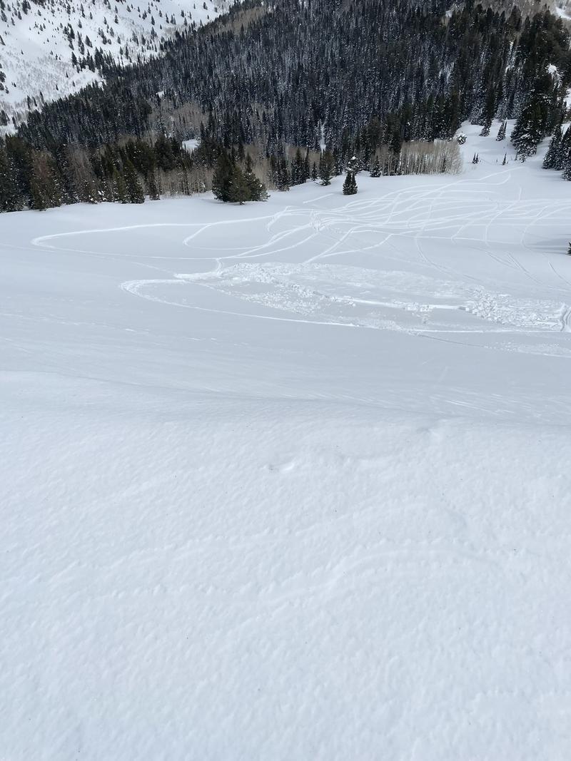
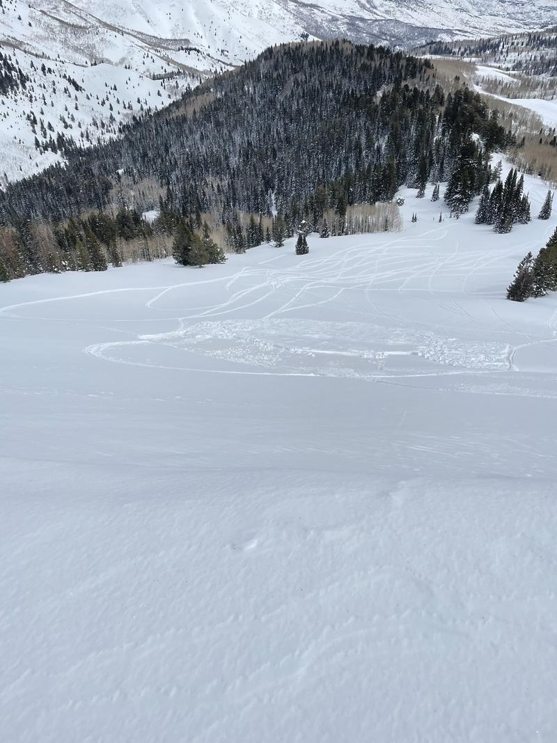
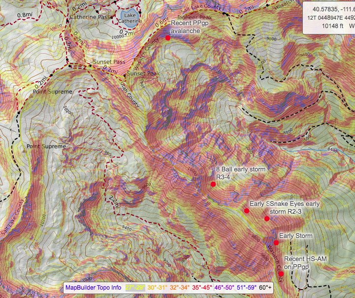
It looks like much of this area avalanched R2-R4 early in the 3/15 storm cycle, running most of the track including 8 ball, snake eyes, the path in between those, and the smaller path south/down drainage from Snake Eyes. Bed surfaces were filled in with ~10cm of now FCsf snow. Also noted more activity on the PPgp layer, including below cliff bands on south side of Pioneer peak and very recent HS-AM at 9,700' ESE 34* mid slope on 4mm PPgp. The PPgp was still intact on bed surface with steeper slopes above unaffected.
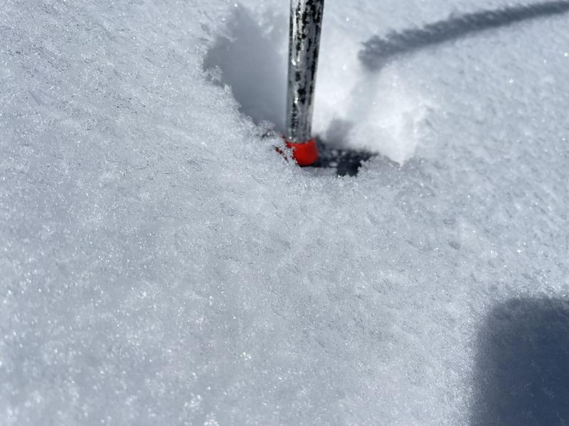
Picture 1: 3-5mm SH
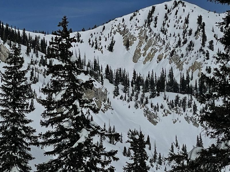
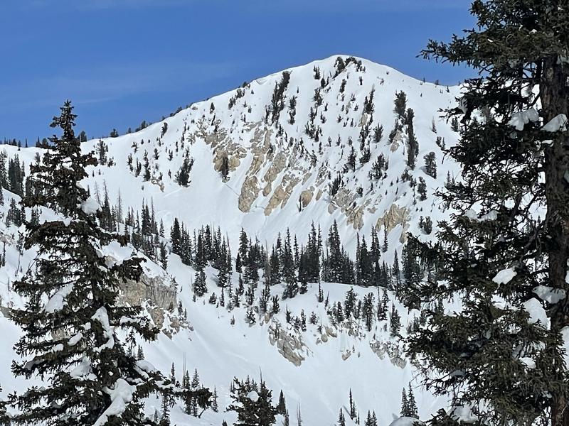
Picture 2 & 3: South side Pioneer Peak avalanche
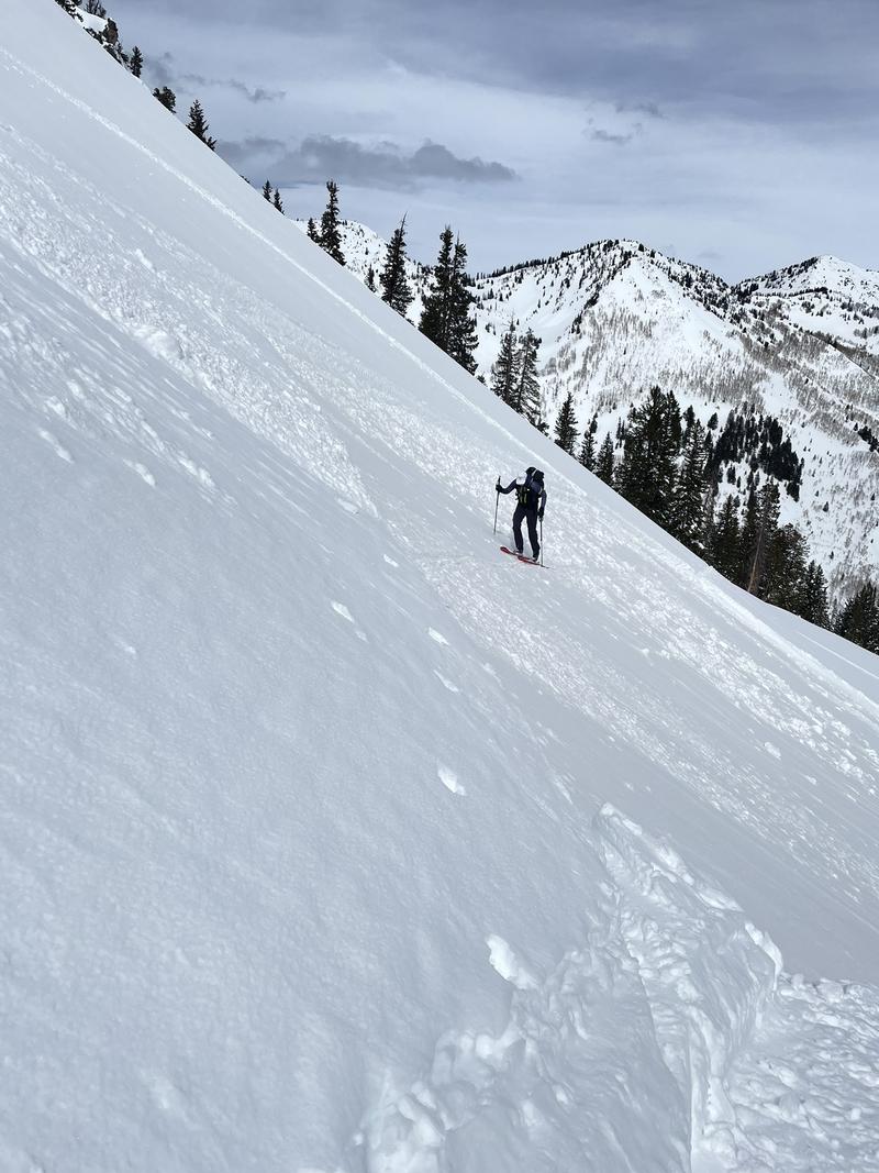
Picture 4, 5, 6; Mid slope 34* HS-AM recent avalanche on PPgp
Picture 7: Approx location of 3/15 and recent avalanches
I am not totally convinced the PPgp layer has healed at this point, and I am almost certain the current weak snow surface will produce touchy avalanche conditions with the incoming storm. I will definitely be avoiding many of the slopes I skied today and similar slopes with the new load. Also, due to the high spatial variability of the weak snow surface and the uncertainty of the PPgp layer a conservative approach to terrain choice over the following days will vital.
Today's Observed Danger Rating
Moderate
Tomorrows Estimated Danger Rating
None
Coordinates