


Brett Kobernik
Forecaster, Website Coordinator
The 2023-24 winter season started out fairly normal.
October:
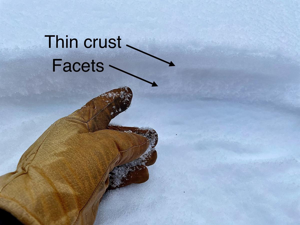
There were a couple of minor snow storms in October that dropped a few inches of snow. This snow melted off everything except the highest north facing slopes. This snow that stuck around faceted (turned to sugary snow) but it wasn't enough to be concerned about as far as acting as a persistent weak layer once more storms came.
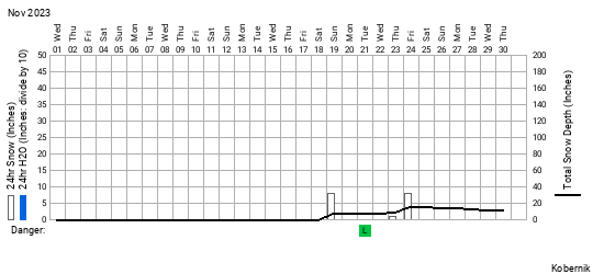
November:
The first two weeks of November was dry. Then, a couple of storms moved through, one on the 18th that produced 8" of snow and one on the 24th that produced 10" of snow. This snow sat around for 7 days which was enough to turn it into small grained facets.

December:
Another storm arrived on Dec 2nd and 3rd bringing 10 to 15 inches of very dense snow. This dense layer that landed on the somewhat weak snow from November was enough to produce some avalanche activity. Collapsing and cracking was noted by backcountry travelers.
There was some minor natural avalanche activity spotted.
There was also one sizable snowmobile triggered avalanche. These all broke into faceted snow from November.
December 8th:
Another small storm moved through on the 8th bringing 5" of new snow. This brought snow depths up to two to three feet in the upper elevations. The snowpack was mostly supportable meaning travel on skis or snowmobiles was fairly easy. Then things took a turn for the worse.
December 8th to the 22nd:
The storms shut off. High pressure moved in and there were unusually warm temperatures through this period. The shallow snowpack took a major hit with this dry spell where most of the snowpack turned to faceted snow. A shallow snowpack that goes through two weeks of dry weather is almost certainly doomed to turn into loose sugary snow. This was the case.


Also, heat crusts formed near the surface on many aspects, even north facing terrain. A crust/facet combo is never a good thing. This can make for very wide and connected avalanches.
By December 22nd, the pack was starting to fall apart and become punchy. It was no longer as supportable as it had been except in areas where there was stout wind drifts and wind slabs. If you step off your skis or machine, boot penetration was right to the ground. Riding a machine, you could feel your track sink and drop into the loose sugar.
By December 22nd, the pack was starting to fall apart and become punchy. It was no longer as supportable as it had been except in areas where there was stout wind drifts and wind slabs. If you step off your skis or machine, boot penetration was right to the ground. Riding a machine, you could feel your track sink and drop into the loose sugar.
DECEMBER 22, 2023 TO JANUARY 3, 2024 - MORE FACETING TAKES PLACE
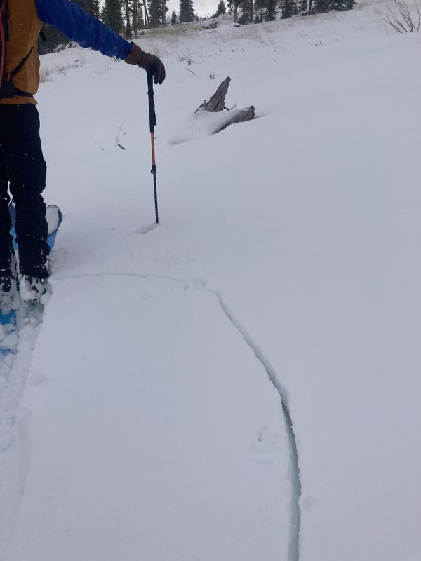
A small storm moved through starting the night of December 22nd and dropped 3 to 5 inches of very low density snow. It was windy during the storm and this produced some small, scattered natural slab avalanches. They broke into the weak facets below. This was only a hint of things to come.
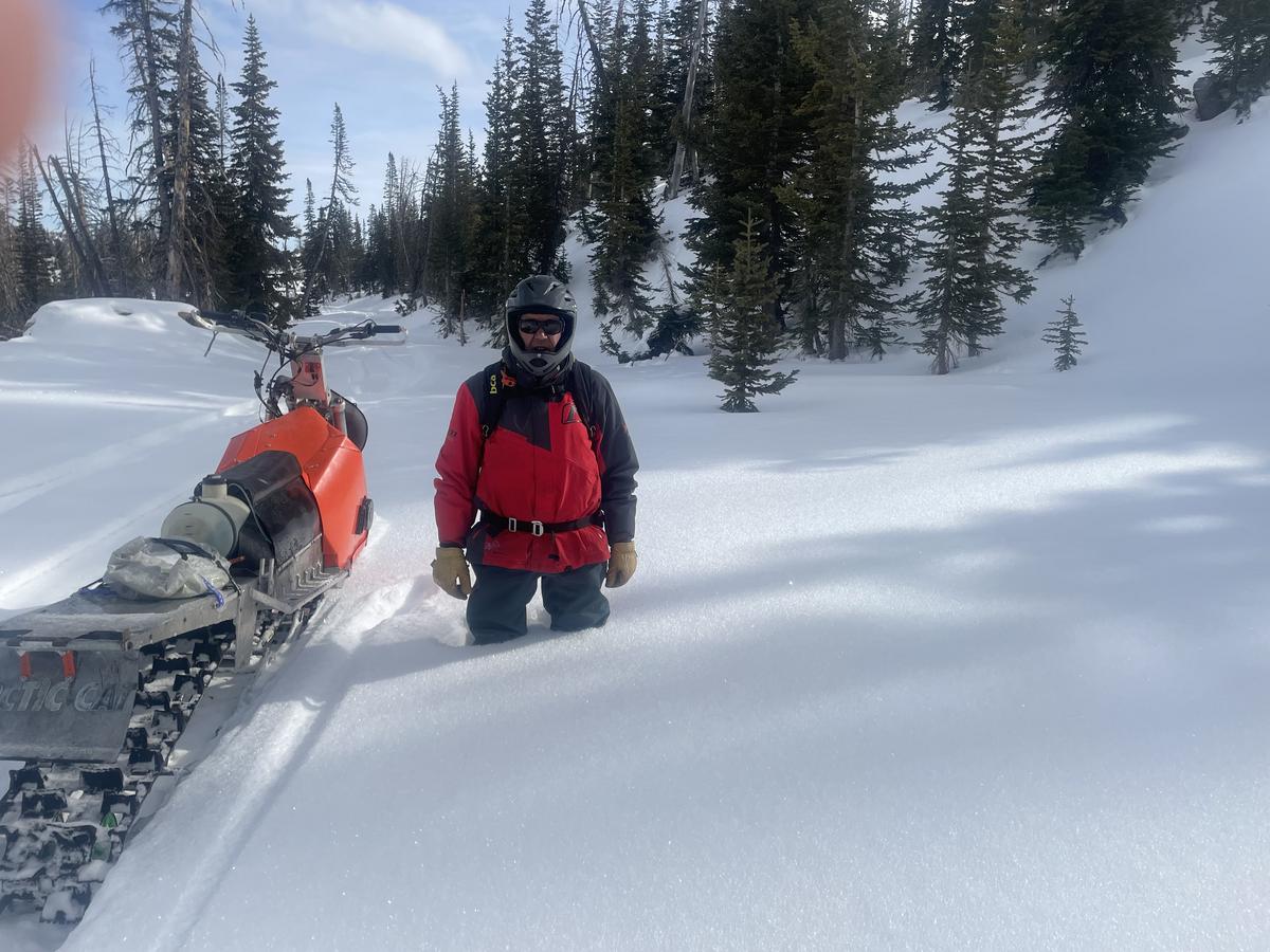
Photo below: Meadows in Ephraim Canyon, Cole Nielson
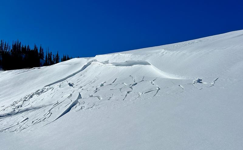
Photo below: Scotty's, Ephraim Canyon, Brett Kobernik
The weather then again turned high and dry with no storms moving through. During this period, the low density snow from the 22nd faceted very rapidly and by January 3 it had joined it's faceted brothers below. The entire snowpack was basically just one big pile of facets. The writing was on the wall. It was going to get dangerous, guaranteed.
JANUARY 3 TO JANUARY 10 - STORMS MOVE IN.
Storms started to move through the night of Jan 3. The first series of storms was in a cold northwest flow. This delivered 2 to 3 feet of VERY low density snow by Jan 7. The structure of this new snow was not quite suitable to produce a significant slab that would cause the underlying weak snow to collapse and avalanche. It was just "fluff on fluff". There was only a few hints that the snowpack was becoming unstable. There were a handful of small soft slab natural avalanches.
Photo below: Small pocket in Blind Fork, Fairview Canyon, Chris Magerl
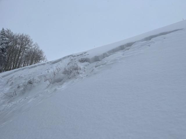
Photo below: Pocket in Electric Lake Bowl, Scott Paine

The snowpack did not exhibit widespread collapsing yet. This is a difficult period for avalanche forecasters as the danger is increasing slowly and they are left waiting to see when the scales are tipped and the real avalanches start happening.
JANUARY 11 TO JANUARY 15, THE SCALES GET TIPPED
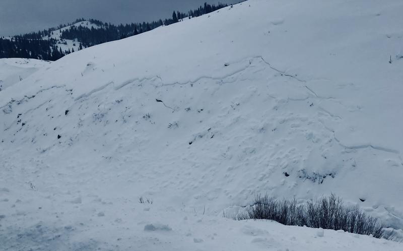
The big turning point happened early morning on January 11. Another good shot of snow fell and the wind picked up. This finally produced a widespread avalanche cycle. Pretty much any slope that a person would touch would collapse under them. The avalanches were still relatively shallow but were becoming much wider.
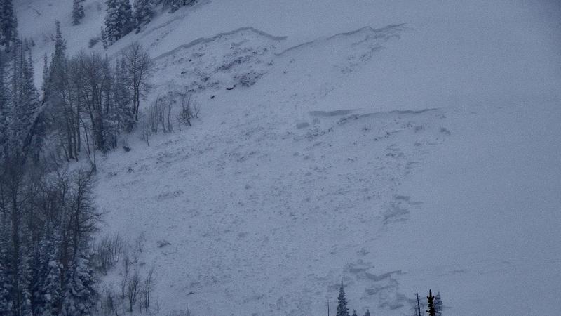
Photo below: South Fork, Spring City Canyon, Brett Kobernik. This avalanche stretched another 1000 feet of the left hand side of the photo into a big open bowl.
During Jan 11, 12, 13 and 14, a round of high density snow fell accompanied by VERY strong wind. The north end of the Skyline received about 2 feet of high density snow. The central and southern end only received a fraction of that. The wind was absolutely relentless for four days. This was the kicker. This is when it really hit the fan. A full blown widespread avalanche cycle was in progress. The fracture lines were now into the 2 to 4 foot deep range. Deeper where the snow was drifted. We will never know the full extent of the avalanche cycle as visibility was very poor during the cycle. Wind and subsequent snow have hidden a lot of the evidence. We have very few photos of the avalanches. What we do know is this was one of the most widespread avalanche cycles that people can remember. These avalanches were not the most destructive but they were VERY widespread. The avalanche danger was rated HIGH for 8 days straight. This is unprecedented on the Manti Skyline.
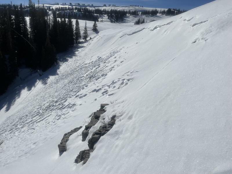
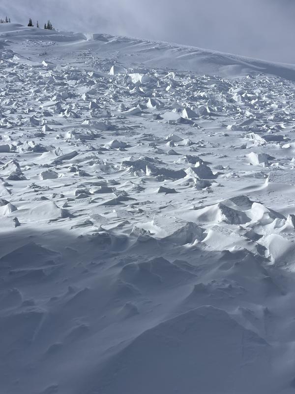
Photo below: Debris from a wide hard slab avalanche, Racetrack, Ephraim Canyon, Kerry Nielson
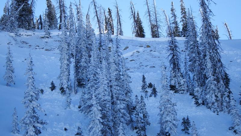
JANUARY 16 TO 24, HUMAN TRIGGERED AVALANCHES
The natural avalanche cycle came to a halt on the 15th but very dangerous conditions continued. There were a few notable human triggered avalanches that occurred between Jan 16 and Jan 20.
Photo below: Snowmobile triggered avalanche in Rolfson Canyon, Jan 16, remotely triggered, no one caught. This was a VERY large avalanche depositing debris 20 feet deep in places.
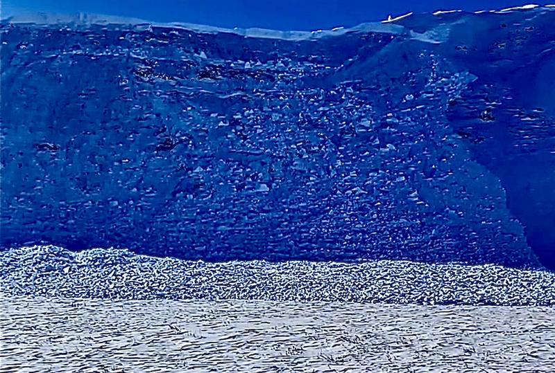
Photo below: Snowmobile triggered avalanche in Spring Creek just south of the kite launch parking lot, Jan 20.
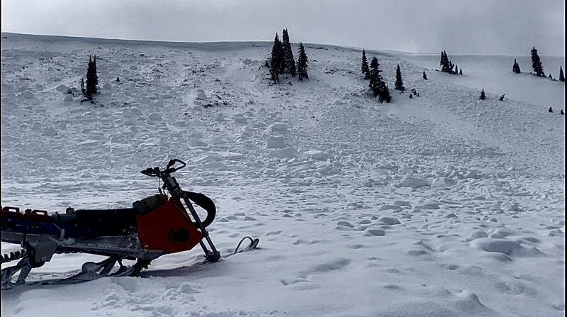
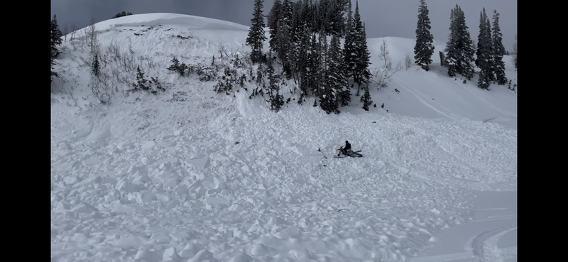
Photo below: Assumed to be a snow bike triggered avalanche in Logger's Fork of Manti Canyon, Jan 20.
Leave a comment