Please help support the UAC rebuild our website backend platform to ensure the ongoing security of the website and the data stored on the site by donating to our spring campaign. Save lives by
making a donation today!
Nowcast- Clear skies overhead reveal a waxing Worm Moon as well as overnight low temperatures which hover just below freezing, Winds blow 10-20 mph from the west along the the high peaks. Riding and turning conditions are aspect dependent... sunnies offer a legit corn harvest that kicks off around 10:00, and working around the compass towards west facing, should last into early afternoon. On the other side of the compass, you'll find a few swaths of shallow, hot pow on upper elevation shadies.
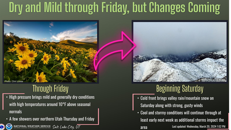
Forecast- A weak cold front slides through the Uinta zone later today. In the meantime, sunny skies give way to increasing clouds as the day progresses with a few scattered snow showers developing by about dinnertime. High temperatures climb into the 40's and overnight lows dip into the mid 20's
Futurecast- Look for a break in the action Friday, but it'll be warm and windy. A good shot of snow is on tap for late Saturday into Sunday. A strong cold front ushers in unsettled conditions and a northwest flow Saturday afternoon into Saturday evening, delivering a period of heavy snow. A lull is slated for early Sunday, before widespread snow showers redevelop with afternoon heating Sunday afternoon.
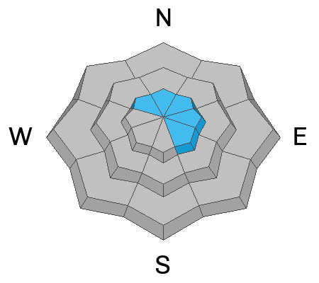
Our good friends at Salt Lake's National Weather Service layout a timeline for a weather change in the graphic above.
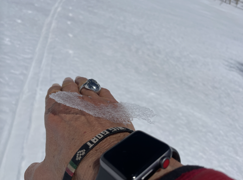
It's been a minute or two since we've experienced such a robust Uinta corn cycle... spring of 2013-2014 as a matter of fact. But, even more of a rarity is the uniform layer of firnspiegel that coats our mountains with a mirror-like sheen. Also known as glacial fire, firnspeigel is a thin ice crust formed on the snow surface on sunny, cold days. The sun's heat penetrates the surface snow layers and causes melt around the grains beneath the surface, but meltwater at the surface is refrozen forming a thin layer of ice. This requires just the right heat balance. It's not a layer that raises any red flags, rather it's an exotic surface, a blast to ski, and sounds like broken champagne glasses cascading down the slope with each turn. The jury is still out, but I suspect the reflectivity enhances my early spring tan :)
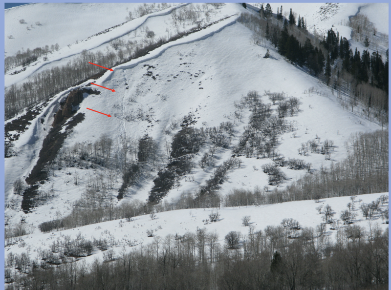
Yesterday, I noticed this piece a corni peeling off a lower elevation ridge, skiddering, gouging, and divoting along the way downslope.
Avy-savvy, snow-pro Trevor Katz, also spotted a natural cornice fall in
Upper Chalk Creek which clearly confirms Issac Newtons laws of gravity. Or in the original words of Bobby Fuller and later emphasized by Joe Strummer... I fought the law and the law won :)
A few days old, but honorable mention-worthy none-the-less-
Along the
Strawberry Ridge, a snowbiker triggered and was caught in a stout wind drift, breaking 2.5' deep and 300' wide.
Near Currant Creek Peak, Chad spotted a meaty slab avalanche breaking 4' deep and 150' wide, triggered by a sledder riding nearby.
For all Uinta observations and recent avalanche activity click
HERE.