

Observation Date
Wednesday, December 24, 2014
Avalanche Date
Sunday, December 21, 2014
Region
Skyline
Location Name or Route
Wedding Ring Ridge, Phone Shot, Spring Creek, Lake Fork
Elevation
10,000'
Aspect
East
Slope Angle
38°
Trigger
Natural
Avalanche Type
Hard Slab
Avalanche Problem
New Snow
Weak Layer
Facets
Depth
3'
Width
500'
Vertical
300'
Comments
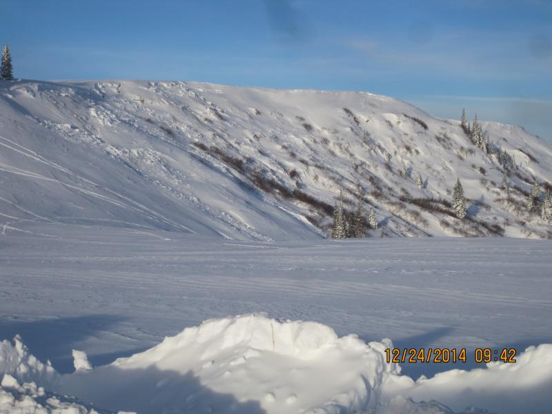
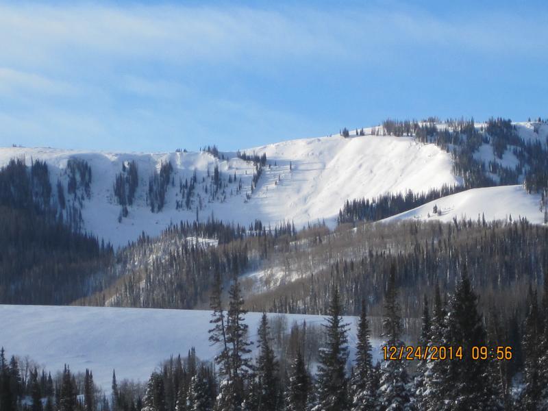
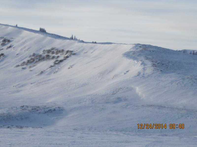
Too many avi's to list one at a time, Big Drift, Wedding Ring Ridge, Spring Creek, Lake Fork, Staker Canyon, in multiple places, cornice falls and slabs both pulling out during the last storm with totals of 3"-4" of water and 45 cm of new snow, coupled with nuking winds that followed at end of storm and the day after made today the Tour de Carnage with activity all over the place, so I grouped this class all together, will add another ob for the treeline cycle that also occurred, Lots of photos, but the theme is the same, weak existing shallow pack overloaded by shear weight of 3"-4" of water, and the typical Skyline WSW winds producing an extensive avalanche cycle during the storm, some areas blown back in with lower density snow that fell on tail end of storm

Coordinates