

Observer Name
Ted Scroggin
Observation Date
Sunday, January 26, 2014
Avalanche Date
Monday, January 20, 2014
Region
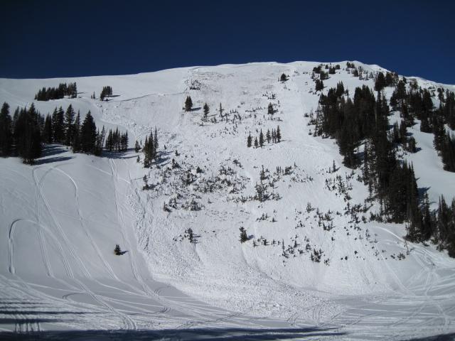
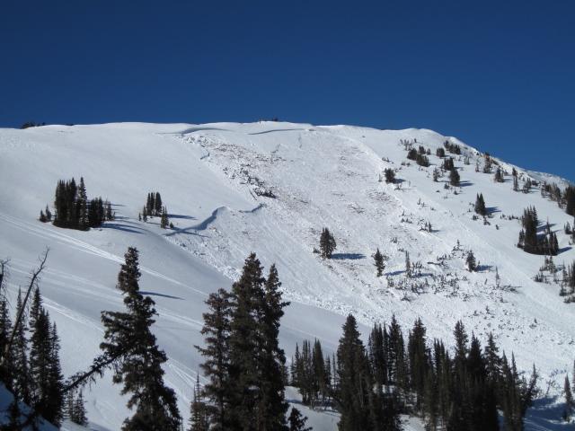
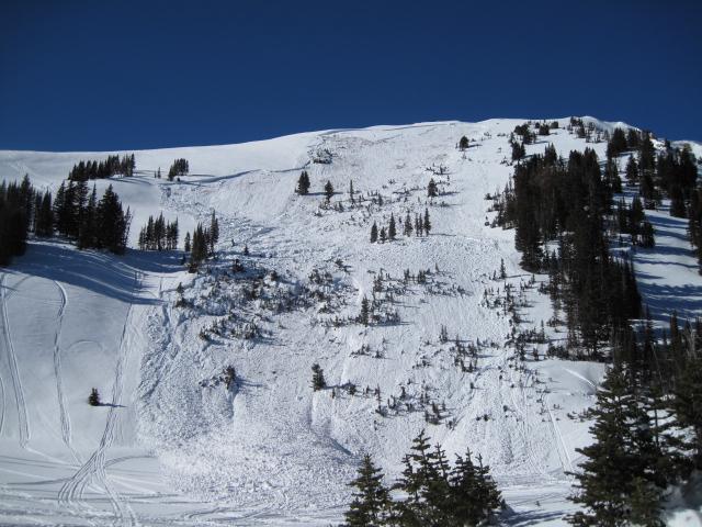
Uintas » Bear River Ranger District » Bear River West Fork » Moffit Basin
Location Name or Route
Moffit Peak
Elevation
10,900'
Aspect
East
Slope Angle
35°
Trigger
Snowmobiler
Trigger: additional info
Unintentionally Triggered
Avalanche Type
Hard Slab
Avalanche Problem
Persistent Weak Layer
Weak Layer
Depth Hoar
Depth
8'
Width
300'
Vertical
800'
Comments
Thought I would check-out some more east facing terrain with similar terrain features as the two slides that occurred in Super Bowl and a very large avalanche on Double Hill. Looks like another slide was triggered sometime from the holiday weekend on the east side of Moffit Peak. This was likely another heavy wind loaded slope with very weak snow near the ground and just waiting for someone to collapse the slope from a shallow thin spot. It's really difficult to tell where and what sled tracks may have triggered this avalanche.
Coordinates