Forecaster Note: I visited the site the day after the accident with two Weber County Search and Rescue members, Bryan Bennett and Mike Fogg. Here are some photos and a quick summary. I will edit a more complete video and add additional information and a snow profile as time allows. Bruce Tremper
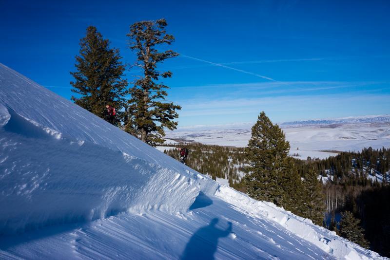
"Whisky Hill" is a steep, popular hill climbing area on the eastern flanks of the Monte Cristo snowmobiling complex between Huntsville and Woodrruff Utah. The paved summer road between Huntsville and Woodruff passes near Whisky Hill but the road is not plowed in winter, making it a popular snowmobiling area. To get from the road to the bottom of Whisky Hill, most people have to descend one of two narrow, steep-sided ravines, one on the north side or one on the south side.
A group of very experienced and well-avalanche-trained snowmobilers decided to descend the ravine on the south side of Whisky Hill. They were the first group to descend this gully since the last storm. They were spread out and the lead snowmobiler triggered a large, hard slab avalanche as he descended in the bottom of the ravine. He triggered it from the bottom and it fractured out the entire slope above him, which broke out in a hard slab 4' deep and about 400 feet across. The crown face (upper fracture) of the avalanche was about 250-300 vertical feet above the bottom of the ravine (and the victim).
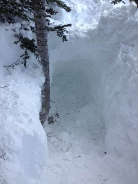
The snowmobiler who triggered the avalanche noticed the slope buckle and he gunned his snowmobile in an attempt to escape but the avalanche caught and buried him in the ravine bottom about 4' deep and buried his snowmobile about 10' deep, just a few feet away from him. Both he and the snowmobile were pushed up against trees. The avalanche partially caught the next rider but he was not buried. The rest of the group quickly located the buried snowmobiler with beacons, then quickly struck him with a probe and several people quickly dug him out. It was a textbook rescue, executed flawlessly. They uncovered the victim in about 5 minutes. Luckily, this group regularly practices rescue scenarios and the practice paid off.
As a final note, they indicated that there was another group of about 6 snowmobilers following them that planned to descend the same gully. They did not appear to have any rescue gear. So perhaps the group that triggered this avalanche prevented a very tragic accident.
The ravine runs roughly east-west and both sides of the ravine are steep sided--around 35 degrees. The slope that avalanched faced southeast, is 35 degrees at the top of the slab and 32 degrees on the lower half of the slope. The slope is only about 300 vertical feet and the avalanche was about 250 vertical feet from the fracture line to the bottom of the ravine and about 300 vertical feet to where the debris stopped as it traveled down the ravine. The slope is un-treed. Above the slope, there is a large, flat fetch, which is near the top elevation of the surrounding terrain, so the wind obviously had deposited a wind slab onto the steep slope. Strong northwest winds over the previous days transportd a lot of snow onto the downwind southeast facing slopes.
The avalanche was a very hard and thick slab formed from wind-deposited snow. The weak layer was a layer of faceted snow that formed in the first half of January. A period of heavy snowfall occurred during the last couple weeks of January capped off by strong winds from the northwest for the 2-3 days previous to the accident.
It's unusual for faceted snow to form on slopes that face the south half of the compass in Utah because at this latitude, the sun usually is warm enough to either prevent the formation of faceted snow or destroy it after it forms. For whatever reason, we have noticed a number of other avalanches on southeast facing slopes with a similar snowpack structure.
My snow profiles along the crown face of the avalanche showed Extended Column Tests failing on easy elbow taps and Compress tests failed on easy elbow taps as well (ECTP-11) (CT-11 x3). All failed on the faceted snow layer about 4 feet deep.
The avalanche advisory from the Utah Avalanche Center for the Ogden area mountains called for a Considerable Danger (orange, level 3) because of persistent slabs and recent wind drifting.
This is a 15' deep hole where they dug out his snowmobile. The top of the snowmobile was about 10 feet deep. The victim was buried about 4' deep.
A composite photo overview of the slide area. The victim was buried up against the trees in the bottom of the ravine in the right of the photo. This is a southeast facing slope about 8,700', 35 degrees and the avalanche slid about 250 vertical feet. it was triggered from the bottom as a snowmobiler descended the ravine.
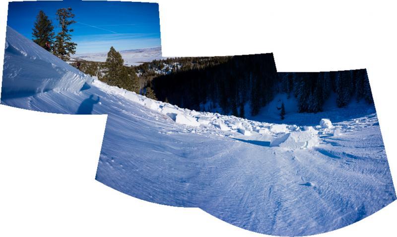
The snowmobiler was buried up against the trees in the bottom right of the photo.
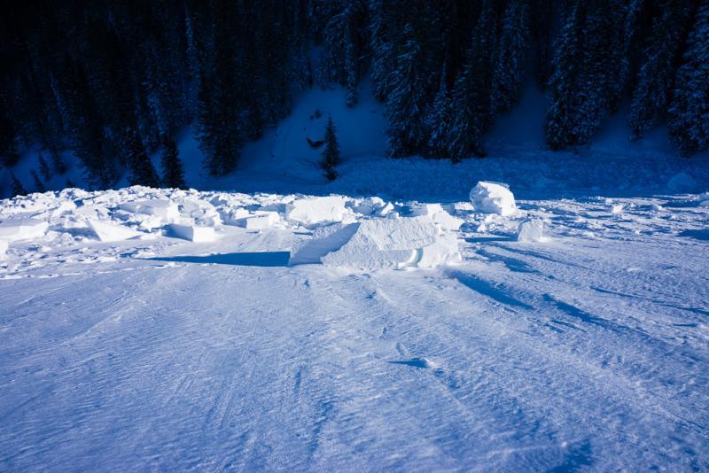
A portion of the 4' deep crown face of the avalanche. it failed on weak, faceted snow formed in early January. The slab was very hard wind drifted snow.