

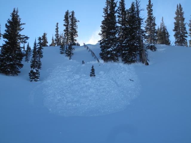
Observer Name
Ted Scroggin
Observation Date
Friday, December 21, 2012
Avalanche Date
Thursday, December 20, 2012
Region
Uintas » Bear River Ranger District » Whitney Basin
Location Name or Route
Whitney Basin
Elevation
10,000'
Aspect
Northeast
Slope Angle
36°
Trigger
Snowmobiler
Trigger: additional info
Remotely Triggered
Avalanche Type
Hard Slab
Avalanche Problem
Persistent Weak Layer
Weak Layer
Facets
Depth
4'
Width
150'
Vertical
300'
Comments
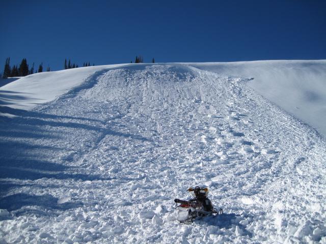
This slide on Yamaha Hill may have occured yesterday, but not sure on the trigger? There are some sled tracks nearby which could have made this a remote trigger?
Comments
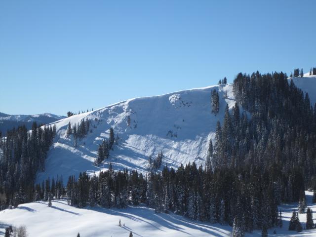
This slide in the Super Bowl area likely ooccured early in the week when the area was going through a pretty good natural avalanche cycle. Many of the slides I observed have some east in their aspect and the slides broke to the ground.
Comments
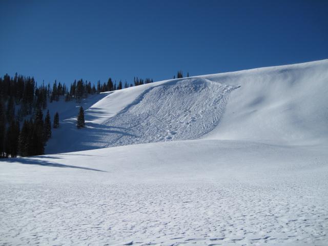
This small slide looks to be fairly recent, possibly yesterday and my guess is that it was triggered from a distance lower on the slope.

Comments
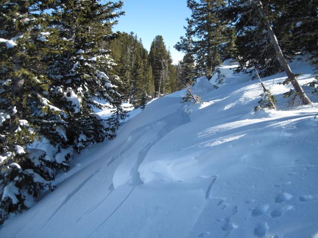
I triggered this slide while walking the ridgeline on a northeast facing slope. I experienced a collapse first, then observed the crack and moving slab. The crown was 3' deepx50' wide and ran about 150' vertical. Recent new snow and steady winds have likely overloaded the buried faceted snow that was located in the middle of the snowpack.

Coordinates