Forecast for the Uintas Area Mountains

Saturday, November 15, 2014
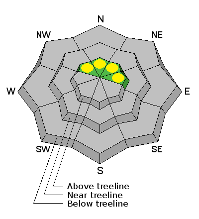
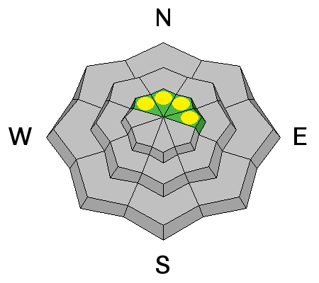
In general the avalanche danger is LOW but any slide triggered today will break to the ground and could result in a trauma inducing injury.


In general the avalanche danger is LOW but any slide triggered today will break to the ground and could result in a trauma inducing injury.

While we're waiting for winter, save the date and join us Nov. 22nd as the Alpine Assassins AA5 Utah film premiere rolls out at the Egyptian Theater in Ogden Utah. Doors open at 6:00 and Movies will start at 7:00. Lots of door prizes, raffles, and giveaways.
Also... now is the time to contact us if you want to schedule a free avalanche awareness talk for your group, club, or shop.
Shoot me an email- [email protected]
A nice shot of snow developed overnight, especially right around Trial Lake and Bald Mountain Pass where 7" of snow stacked up since midnight. West and southwest winds cranked into the mid 30's and 40's for a few hours early this morning, but have just recently become a bit more manageable, backing off into the teens and low 20's. Temperatures are in the low to mid teens. Early season riding and turning conditions are extremely limited to a few upper elevation north facing slopes.
Nearly all the weather stations in our network are up and running. Click here for current winds, temperatures, and snowfall throughout the range.
No recent avalanche activity to report.

Remember- just cause you can see it from the road doesn't necessarily mean it's safe.
You'd be pretty hard pressed to trigger an avalanche today, but it's not impossible. Your choices for riding or turning are limited to a few patches of high elevation snow facing the north half of the compass. Underneath this white facade is early season snow that grew weak and sugary and the strong winds overnight probably found enough snow to blow around and form a stout, supportable wind slab. Today's avalanches won't be particularly large, but they could take you for a nasty ride through rocks and stumps barely hidden underneath the snow, resulting in a season ending injury.
Snow should taper off throughout the morning a skies clear pretty rapidly as the day progresses. The downside... west and northwest winds increase into 40's and 50's along the high ridges and temperatures crash into negative territory overnight. Clear and very cold for Sunday with dry weather and a slow warming trend on tap for the upcoming week.
Remember your information can save lives. If you see anything we should know about, please participate in the creation of our own community avalanche advisory by submitting snow and avalanche conditions. You can call me directly at 801-231-2170, email [email protected], or email by clicking HERE
This is a great time of year to schedule a free avalanche awareness presentation for your group or club. You can contact me at 801-231-2170 or email [email protected]
Donate to your favorite non-profit –The Utah Avalanche Center. The UAC depends on contributions from users like you to support our work.
Benefit the Utah Avalanche Center when you buy or sell on ebay - set the Utah Avalanche Center as a favorite non-profit in your ebay account here and click on ebay gives when you buy or sell. You can choose to have your seller fees donated to the UAC, which doesn't cost you a penny.
Utah Avalanche Center mobile app - Get your advisory on your iPhone along with great navigation and rescue tools.
The information in this advisory is from the US Forest Service which is solely responsible for its content. This advisory describes general avalanche conditions and local variations always occur.
I will update this advisory by 7:00 AM Sunday Nov. 16, 2014.